Geoscience Reference
In-Depth Information
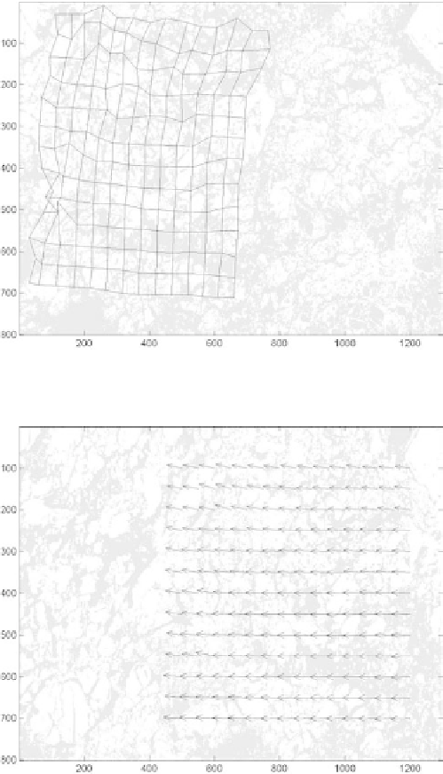
Fig. 5.
Two-class segmentation result of Fig. 3, with deformed grid from Fig. 4.
Fig. 6.
Sea ice motion map on December 11, 2001, derived from Figs. 4 and 5 without
grids.
it is ecient to track ice floes of different sizes and to study ice motion and
deformation.
In Fig. 7, we show a sea ice motion map in Bering Sea on February
23, 2004 as derived from AMSR-E 89GHz data using wavelet transform