Geoscience Reference
In-Depth Information
3.2.
Ending stage of snowfall in the coast
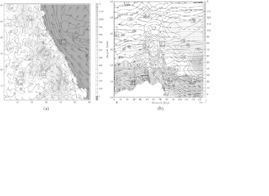
After 18:00 LST, December 8, snowfall band (or rainfall band) moved from
the coastal inland toward the coastal sea, as time went on. As north-
easterly wind prevailed during the snowfall period was gradually changed
into northerly or north-westerly before 09:00 LST, December 9, onshore
wind was confined to the only coast and became weak under the westerly
wind from the upwind side of the mountain toward the coast, resulting in
the movement of snowfall band into the coast (Fig. 8).
Similar to the case of snowfall, snowfall band directly coincided with the
area of relative humidity of 100% and simultaneously, the area of minimum
sensible heat flux. Under the northerly and north-westerly winds, moisture
advection from the sea into the inland became weaker and weaker, inducing
the formation of a small amount of clouds or no cloud in the inland basin
like Kangnung city.
From 09:00 LST, December 9, north-westerly wind parallel to the coastal
line could not induce sucient amount of moisture advection from the sea
into the inland basin and further the top of the mountain, resulting in
the formation of small amounts of clouds in the coast (or no cloud) and
sequentially, no snowfall occurred in the city (Fig. 9).
Fig. 8. (a) Surface wind (m/s) at 10 m height over the ground surface at 06:00 LST
December 9 near the ending time of snowfall. (b) Vertical profiles of wind (m/s), relative
humidity (%) and air temperature (
◦
C).