Geoscience Reference
In-Depth Information
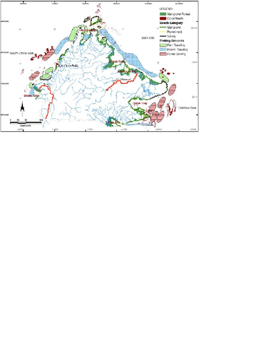
Fig. 1. Map of Sabah showing capital, major rivers, mangrove, coastal classification,
coral reef data, and fishing information.
development while preserving natural resources, but can do little about the
development in the upstream catchment.
The aim of the Shoreline Management Plan study is to produce a devel-
opment plan for the Sabah shoreline which is sensitive to the particular
conditions of the coast and is consistent with the general development poli-
cies of Sabah State.
2
,
3
The methodology applied to develop a shoreline
management plan for Sabah is considered an example to be followed along
many coastal areas in Southeast Asia, and around the world, in resolving
the impact of inland development on the coastal environment.
2. Measurements and Methods
Numerical models served to integrate the available information to hind-cast
and now-cast physical conditions and predict the consequences of different
development scenarios.
Sabah was divided into 79 subcatchments and the rainfall-runoff cal-
culated. Sediment and pollution load were also calculated. The sediment
and pollution loads were imposed in the coastal models to simulate the