Geoscience Reference
In-Depth Information
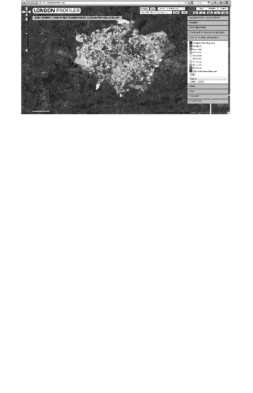
FIGURE 4.2
GUI of the London Profiler showing an example of a choropleth map overlaid on Google Maps
(London Profiler, 2013, available at http://www.londonprofiler.org/, accessed on June 10, 2013).
A number of different terms have been used to describe these applications, including
map mash-
ups
(Purvis et al., 2006),
map hacks
(Erle et al., 2006) and
Mapplets
(Google, 2008). Regardless of
the term being used, what is at the core of this new GeoWeb are tools and standards for collecting,
storing and sharing information. Turner and Forrest (2008) term this the geostack, which allows for
the creation, publication, sharing and consumption of map-based information. However, as Haklay
et al. (2008) note, the potential for map mashups has been around since 2000 via the OGC, while
the concept of the geostack has been reported in the literature for decades (see Kohn, 1970 cited in
Haklay et al., 2008). What is now different is the availability of readily accessible technology for
the creation of such applications.
These developments in geographical services and applications have empowered the general pub-
lic to produce geographical information, giving rise to the GeoWeb 2.0. It is not only the general
public that sees the benefit of GeoWeb 2.0 but also researchers (e.g. Longley and Singleton, 2009), in
the sense that GeoWeb 2.0 architectures make results from research accessible to the wider public.
This moves geographical products away from the expert to the spatially illiterate. Table 4.1 sketches
out the differences between GeoWeb 1.0 and 2.0. Following Grossner et al. (2008), in addition
TABLE 4.1
Differences between GeoWeb 1.0 and 2.0
GeoWeb 1.0
GeoWeb 2.0
Static 2D map sites (e.g. PARC Map Viewer)
Dynamic 2D maps, globes and Earths (e.g. Google Earth,
ArcGIS Explorer)
File transfer (ftp)
Direct use Web services (e.g. Google Maps, Bing Maps)
Clearinghouse nodes (e.g. Alexandria Digital Library)
Catalogue portals (e.g. geodata.gov., INSPIRE, USGS)
Individual websites (e.g. Multimap)
Web service mashups (e.g. London Profiler, Oakland
Crimespotting)
Proprietary protocols (e.g. AXL)
Standard protocols (e.g. W3C SOAP/XML, OGC WMS, GML)
User-hosted services
Remotely hosted services (e.g. ArcWeb Services)
Source:
Maguire, D., GeoWeb 2.0: Implications for ESDI, in:
Proceedings of the 12th EC-GI&GIS Workshop
, Innsbruck,
Austria, 2006.