Geoscience Reference
In-Depth Information
(a)
(b)
1
1
0.8
0.8
0.6
0.6
0.4
0.4
0.2
0.2
0
0
0
200 400 600 800
Distance from roads
1000
8 18
Percent slope
28
(c)
(d)
(e)
(f)
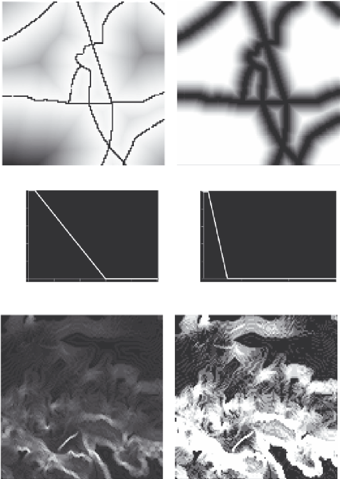
FIGURE 12.5
Maps of geographical data and analytical results of that data are shown: (a) roads superim-
posed on distances away from roads, (b) the fuzzy membership of the set of locations near roads, (e) the slopes
and (f) the fuzzy membership of gentle slopes and the fuzzy membership functions (c) and (d) to transform (a)
into (b) and (e) into (f).
(1996), in rather different contexts, extend this conception by showing how uncertain soil boundar-
ies can be added to a standard soil map. Soil mapping is aimed primarily at improved land manage-
ment, and many have argued that land evaluation, based on soil mapping, is better and more reliably
treated by fuzzy sets than by crisp sets (Burrough, 1989; Wang et al., 1990; Burrough et al., 1992;
Davidson et al.,
1994). MacMillan et al. (2003) made extensive use of fuzzy classification rules to
automatically classify landform-based spatial entities.