Geoscience Reference
In-Depth Information
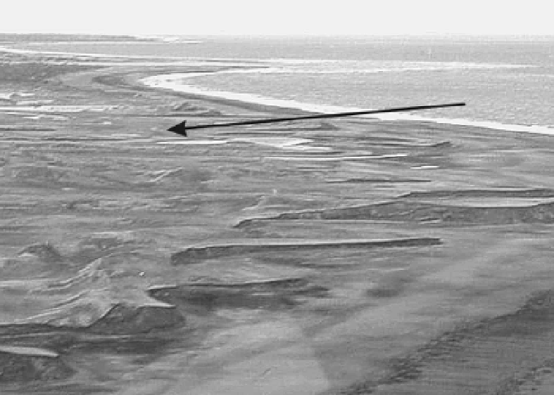
Figure 4.7.
Area of greatest impact on dunes by Tropical Cyclone Vance. Here, three
rows of 6--7 m high dunes were overtopped and completely removed by marine
inundation. Note that vegetation which formerly consisted of grasses, shrubs and
small trees was also removed. The large arrow shows the direction on onshore flow.
Photograph by B. Hanstrum, Bureau of Meteorology, Western Australia.
approximately 400--500 m wide and 200--250 m inland from the first row of dunes
(Fig. 4.7).
This sand splay decreased in thickness from 1.5 m immediately to the rear
of the position of the former third row of dunes, to 0.75 m thick at its most
inland extent. The splay terminated abruptly at a salt marsh where it was
marked by a steep fronted (
∼
30
◦
angle) toe slope. Sediments within the splay
were depositedassteep(
∼
30
◦
)tabular cross-beds (Fig. 4.8). Medium to coarse-
grained sand occurred at the base of the unit, along with clasts of coral and
shells, and graded upwards into medium- to fine-grained sand. The tabular cross-
beds, along with other field evidence, suggested that the surge struck the coast
with considerable force and moved inland as a reasonably high velocity bore.
Such conclusions were supported by the presence of scour pits measuring up to
10mlongand3mwideonthelee(inland) side of trees, imbricated gravels and
small boulders of lithic rock within the splay on its seaward side, and the shear
volume of sand transported inland.
At present, too few studies have been undertaken to develop facies models
that allow distinction between sand splays deposited by tropical cyclones and
Search WWH ::

Custom Search