Geoscience Reference
In-Depth Information
Much of the work to characterize saline ground water resources in the US was
done in the 1950s, 1960s, and 1970s. Surveys of saline water resources of several
states (e.g., Winslow and Kister, 1956), and of selected areas within states (e.g., Hood,
1963), were published in the late 1950s and early 1960s. Krieger et al. (1957) under-
took a preliminary survey of the saline water resources of the US during this period.
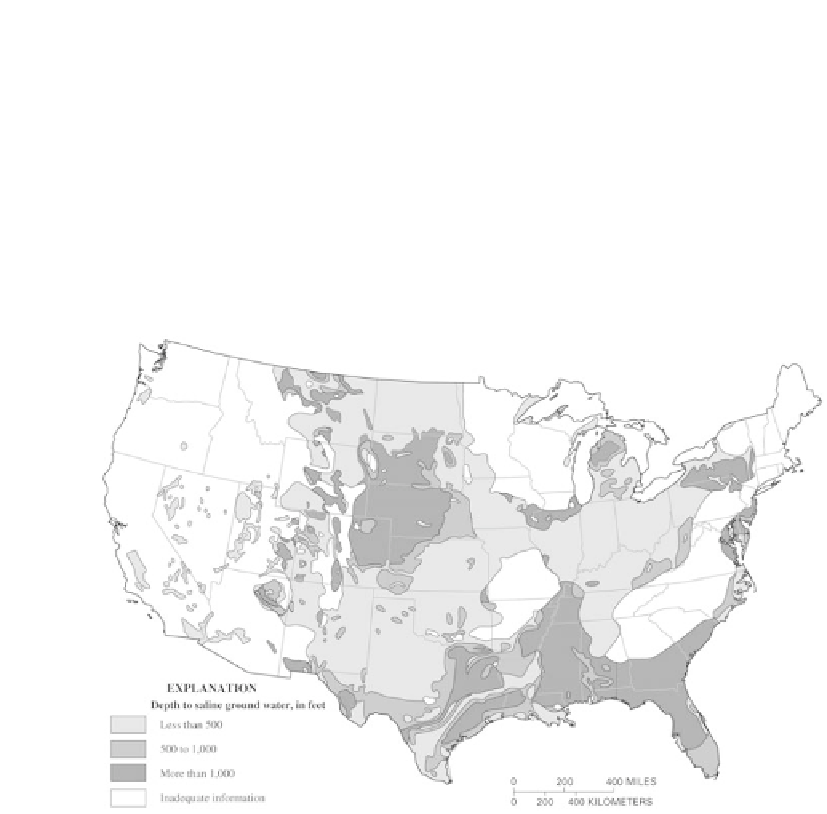
Later, Feth at el. (1965) prepared a generalized map of the depth to saline ground water
for the conterminous US (Figure 1). This map provides a preliminary perspective on
the location of saline ground water resources, but provides limited information about
critical factors required to understand the development potential of the resources such
as aquifer hydraulic conductivity and well yields.
Figure 1.
Depth to saline ground water in the US (generalized from Feth et al., 1965).
Reports published in US Geological Survey (USGS) Professional Paper Series
813 in the 1970s present very generalized analyses of ground water resources within
each of the 21 Water Resources Regions of the US. Many of these reports contain a
short summary statement about the saline water resources of a region, including use
of saline aquifers as a source of treatable water, place to store freshwater, or place
to dispose of liquid waste. Subsequently, the USGS developed quantitative assess-
ments of 25 of the Nation's most important regional aquifer systems, as part of the Re-
gional Aquifer-System Analysis (RASA) Program (USGS Professional Paper Series
1400−1425). Reports on the geochemistry of some of these aquifer systems and the
Ground Water Atlas of the US (Miller, 2000) produced as a part of the RASA Program
contain maps and data about dissolved-solids and specifi c ion concentrations for se-
lected areas (Figure 2).