Geoscience Reference
In-Depth Information
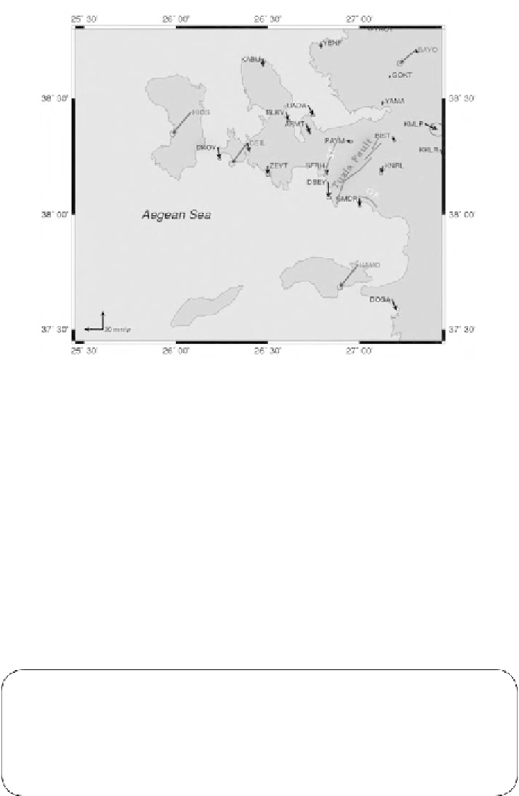
Figure 6.
Red colored arrows indicate the Eurasia fixed velocity vectors, black arrows indicate the
Anatolia fixed velocities (Aktug and Kilicoglu, 2006; McClusky et al., 2000), blue lines indicate faults
In conclusion, this chapter, a plan for deformation monitoring studies using geo-
detic techniques including network design and optimization was prepared. The next
step of this study will be three GPS campaigns on the designed network in two periods.
In addition to GPS technique, conventional geodetic techniques such as precise level-
ing technique would be a choice for normal faults where small vertical deformations
need to be determined. Further studies will be built on the information and techniques
introduced in this study. It is certain that geodetic techniques are capable of determin-
ing small movements which are quite valuable information for earth sciences. More-
over, geodetic results can be valuable information for management systems in terms
of the decision making based on characteristics of the geological features of the study
area.
KEYWORDS
•
Geodetic crustal deformation
•
GPS measurements
•
Network design
•
Seismic risk
•
Seismicity