Geoscience Reference
In-Depth Information
Satellites allow interpolation of PM
2.5
data between EPA monitors on the ground.
“That's the great revolution, really,” Haynes says. “You get much better representa-
tion of PM
2.5
concentrations over an area.” Another key benefi t of the study is that the
detailed individual-level health data provided by Kaiser Permanente (a health care
provider) enables researchers to more accurately evaluate the role PM
2.5
may be play-
ing in complex medical conditions. The HELIX researchers expect to soon publish
their fi ndings on the links between satellite and ground monitor data.
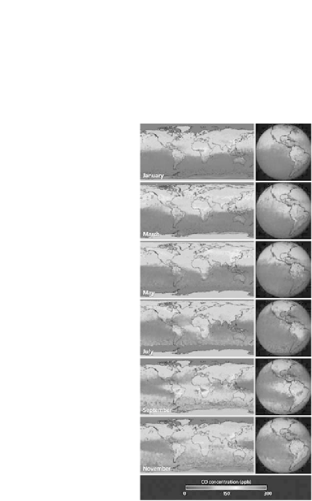
Figure 3.
The CO spreads hundreds and thousands of miles, as seen in these images of concentrations
at about 12,000 feet. The data were collected in 2004 by the MOPITT (Measurements of Pollution in
the Troposphere) sensor on NASA's Terra satellite. Red indicates higher concentrations, and purple
indicates lower concentrations. These concentrations tend not to pose a direct health threat, but
serve as a tracer for a variety of other pollutants that can. The CO, produced when carbon-based
fuels burn incompletely or inefficiently, is one of the six major air pollutants regulated in the US and
in many other nations around the world.
Source
:
NASA