Geoscience Reference
In-Depth Information
monitoring network, they can inform the authorities immediately exactly where a quake has
taken place and how severe it is. As we shall see, they may also help to give advance warn-
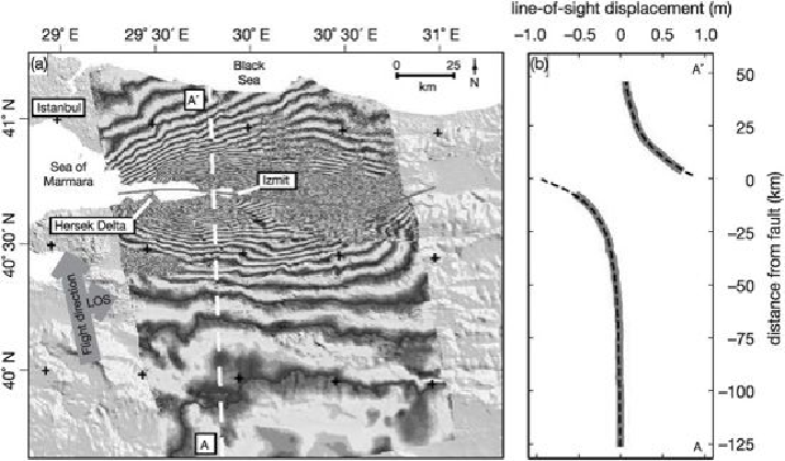
ing. An even clearer image of exactly what has happened can come from space. Remote-
sensing satellites equipped with synthetic aperture radar, or SAR, can record the shape of
the ground surface so accurately that when two images are superimposed, one taken before,
the other after a quake, they produce interference patterns which reveal the precise section
of the fault which moved and its motion.
21. Satellite radar interference map combining data from before and after the Izmit
quake in Turkey in 1999 to reveal the ground movement.
Mid-plate quakes
Even the seemingly rigid slabs of the continents are subject to stresses and strains, and oc-
casionally they move. The biggest earthquake in the brief recorded history of the United
States took place not in California but in the eastern USA. In 1811 the frontier town of
New Madrid near St Louis was rocked by three massive quakes measuring up to 8.5 on the
Richter scale. They were powerful enough to ring church bells in Boston and, had great
modern cities existed then in the broad Mississippi plain, they could have been flattened.
No one is sure whether the quake was due to the ground subsiding under the weight of Mis-
sissippi sediments or whether the mighty river itself owes its existence to the crust being
stretched. It could be that this is another line along which an ocean tried to open, before