Geoscience Reference
In-Depth Information
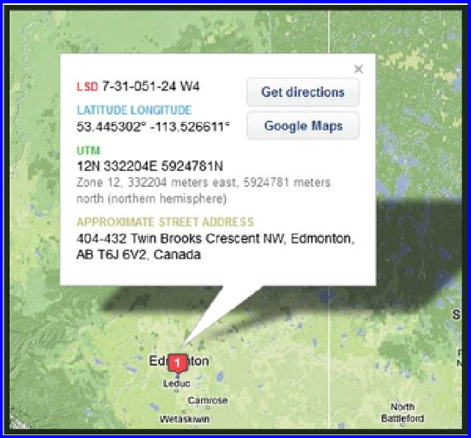
Figure 2.2 Edmonton, Alberta, Canada. Description using different coordinate sys-
tems. Source: BaseLoc (
www.baseloc.com
), division of GPS Police (
www.gpspolice.
com
), Calgary, AB.
is then divided into quarter-sections, and each quarter section into further
quarters and halves. The resulting coordinate for a parcel of land could be
“Northwest 1/4 of the southeast 1/4, Section 6, Township 2 South, Range
55 West, Sixth Principal Meridian.” Therefore, this system, while useful for
identifying tracts of land on property deeds, is restricted to land areas only.
The land areas can be quite small and specific, but the system is not meant
to identify individual points.
The Military Grid Reference System (MGRS) is the fifth and final system to be
treated here, used by North Atlantic Treaty Organization (NATO) militaries for
determining absolute location. MGRS is derived from the UTM system but cov-
ers the entire Earth and uses a different labeling convention than does UTM.
It consists of three parts: A grid zone designator, a 100,000 square meter
identifier, and a number that corresponds to the easting and northing in that
cell. The resolution of a full MGRS coordinate is a one meter square, and if
digits are left off, it can be used to represent blocks of 10, 100, 1000, or larger
squares. An example of a one meter MGRS address is 4QFJ1234567890, where
4Q is the grid zone designator, FJ is the 100,000 square meter identifier, and
the other numbers allow a one square meter cell to be pinpointed.
Search WWH ::

Custom Search