Geoscience Reference
In-Depth Information
Yet another stunning example of converting the old to the new, and bring-
ing out even more than anyone might have anticipated in times past, is built
on ideas from physics, involving population potentials. In the 1940s, social
scientists interpreted some physical principles in a variety of social contexts.
In 1947, J. Q. Stewart used population potentials to depict the accessibility of
people from a given point on a map. Such accessibility is a measurement of
how near people are to a point; the population potential at one place is the
sum of the ratios of the population at all other points to the distances from
the place in question, to those points. Demographic gravitation is the physical
model suggesting that concentrated groupings of people (urban populations)
serve as an attractive force to pull in more people.
The 1940s work of J. Q. Stewart, as well as G. K. Zipf (1946, 1949) and others,
find interesting correspondences, at least some of which appear to stand the
test of time. While J. Q. Stewart interpreted gravity in terms of demography,
W. J. Reilly had earlier related it to the economics of retail activity (1929, 1931).
Zipf associated the concept of gravity with a dynamic “demographic energy”
which led him to postulate some concepts about trip distribution through grav-
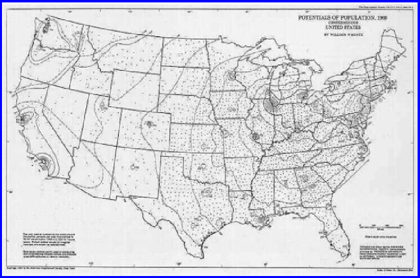
ity models. Warntz, in 1965 created a map of the 1960
Potentials of Population
(Figure 10.3). In more contemporary times, Michael Batty, University College
Figure 10.3 Warntz's hand-drawn population potential map based on 1960 data
(William Warntz, 1965, “A note on surfaces and paths and applications to geo-
graphical problems”). Reprinted here with permission of John D. Nystuen, Editor,
Michigan Inter-University Community of Mathematical Geography, Papers, in
image/micmog.html
Search WWH ::

Custom Search