Geoscience Reference
In-Depth Information
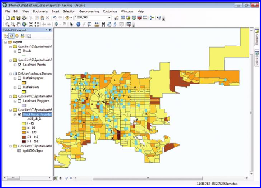
Figure 5.11 Choropleth (graduated color) map of 18 to 21 year-olds, shaded by Block
Group. Source of base map: Esri software.
Experiment with the size and color of the dots. Next, vary the number of dots
per person aged 18 to 21 years. Which size, color, and number of dots convey
the meaning of the map most clearly? How can you best communicate the
message to your map readers that the placement of the dots does not indicate
where the 18 to 21 year-olds actually live within each block group? As you can
see, with a desktop GIS such as ArcGIS for Desktop, you have much more flex-
ibility in changing the symbology than with web-based GIS. Think about what
other information you might wish to have. Then, go on to the future chapters
where this problem will be revisited in greater detail. Often, it is a good idea to
read a problem in advance and think about it broadly and then to revisit it once
more information is known, bearing in mind that what was learned earlier (as
in this chapter and in Chapter 3) might well be important in future activities.
5.5 Related theory and practice: Access through QR codes
Theory
Persistent archive:
University of Michigan Library Deep Blue:
http://deepblue.lib.umich.edu/handle/2027.42/58219
From Institute of Mathematical Geography site:
http://www.imagenet.org/
Search WWH ::

Custom Search