Geoscience Reference
In-Depth Information
of reality. Thus, it is often convenient, for clarity in communication, to call
a map such as one that shows only a downtown area as a map displayed at
“local” scale and one that shows a large part of a nation as a map displayed at
“global” scale. Again, “local” and “global” scales are relative terms; they offer
an alternative way to capture the parallel idea as “large” and “small” scale.
Remember: A single map cannot be correctly characterized as being “large”
scale—that is a relative term and a second map must be present for such a
phrase to have meaning.
While the representative fraction is important in determining the size of the
scale of one map in relation to another, the bar scale has become of increas-
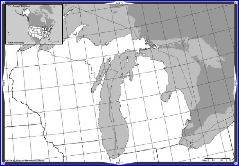
ing importance with the advance of technology. Figure 5.2 shows a map of
Michigan, produced using the National Atlas' MapMaker tool, with a bar scale
in the lower right corner.
When a map is digitally or otherwise enlarged or reduced, its scale changes.
But, if what is written on the original map is simply 1:50,000, then when the
map is reduced, the representative fraction should change—one inch will no
longer represent 50,000 inches (in fact, it will represent more than 50,000
inches). But, the scale stated on the reduced map will still read, 1:50,000 in
reduced font size. The reduced map scale will be wrong. If, however, a bar
scale appears on the original map, then that bar scale will also be reduced
and it will correctly portray the scale of the new map. Since a tool such as the
Figure 5.2 Map showing bar scale. Source: Mapmaker, National Atlas of the United
States, March 5, 2003,
http://nationalatlas.gov.
Search WWH ::

Custom Search