Geoscience Reference
In-Depth Information
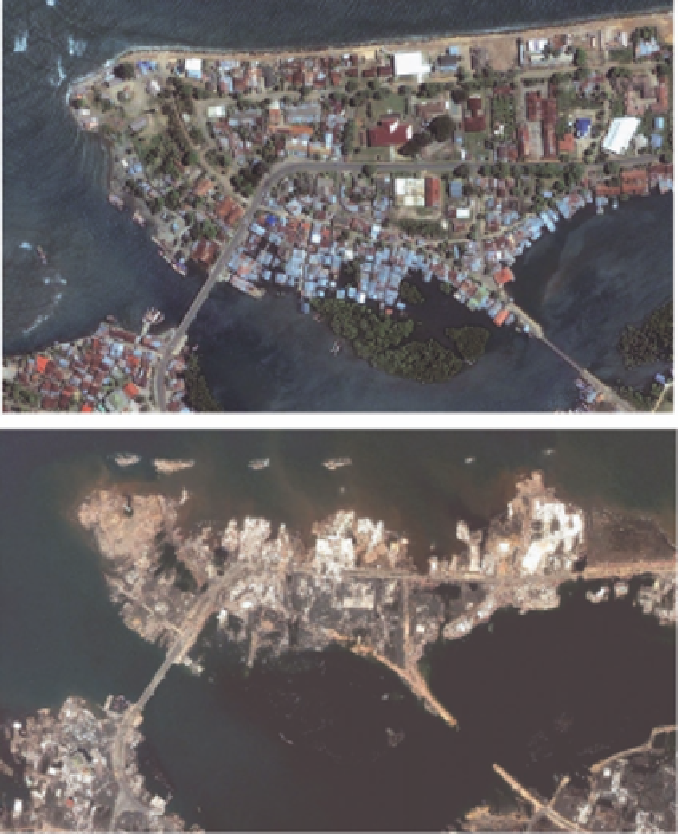
Fig. 13.18. Coastal area of Banda Aceh, Indonesia, before (above) and after (below)
the Indian Ocean-Sumatra earthquake of 2004 (after Quickbird)
Onewaytocopewiththisistouseasimplifieddesigncharts.Infact,setsofdesigncharts
were developed based on a series of parametric studies on embankments and gravity
structures (Higashijima et al., 2006). These design charts are incorporated in a spread
sheet format. Input data required are: (1) basic parameters defining the cross section of
structures,(2)geotechnicalconditionsasrepresentedbySPTN-valuesand(3)earthquake
data, as represented by wave form, peak ground acceleration, or distance. Alternative
way to cope with this extreme event is to set up a reasonable strategy to evacuate and