Geoscience Reference
In-Depth Information
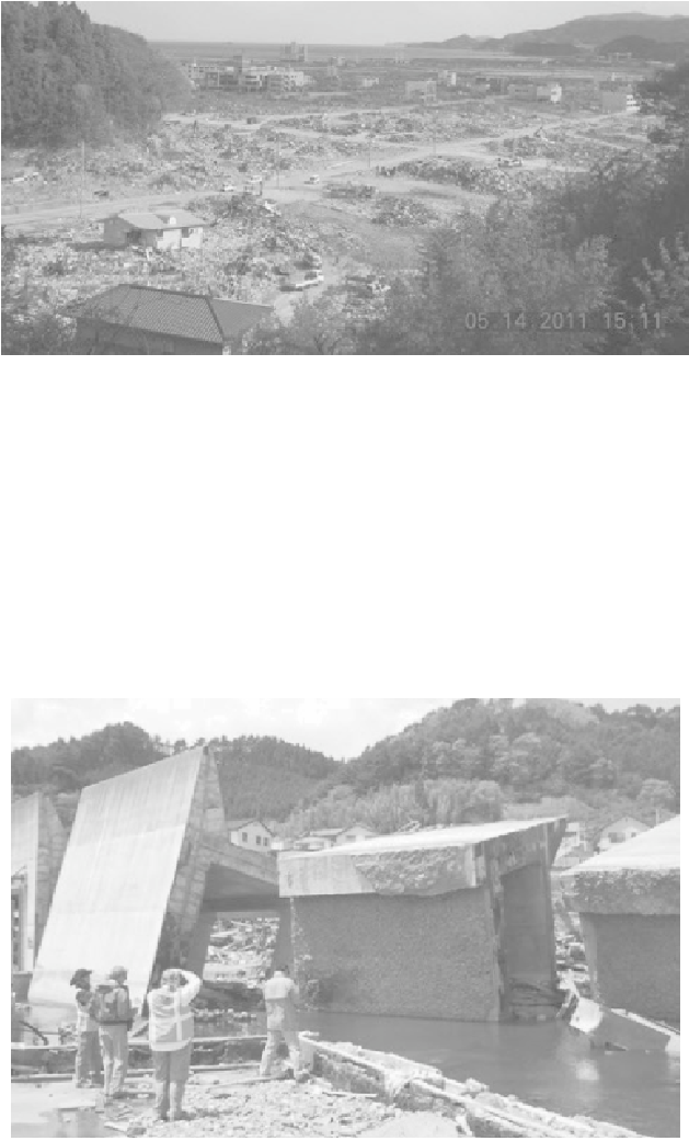
Figure A.7 Rikuzentakata's overwhelming devastation is seen from a hilltop
evacuation point where residents fled.
(Source: Brian N. Jones)
Like so many of the villages along this coast, Kojirahama is located at the bottom of a
steep ravine. The village is protected by a vertical wall 12.5 meters high with a 8.5-
meter base, which was overtopped during the tsunami event, seen in the photo above.
The village was completely destroyed up to an elevation of 17.8 meters, and six
eight-to-12 meter long sections of the massive wall were overturned. A large scour
hole was observed inland of the wall, still filled with water; seen below. Another item
of note was that enough subsidence had occurred in this spot that facilities seaward of
the wall were essentially at sea level.
Figure A.8 Amid overturned tsunami wall sections, a scour hole can be
seen at the base of the middle section.
(Source: Brian N. Jones)
Search WWH ::

Custom Search