Geoscience Reference
In-Depth Information
300
1500
250
1250
200
1000
150
750
100
500
50
250
0
0
Jan.
Feb.
March
April
May
June
July
Aug.
Sep.
Oct.
Nov.
Dec.
Precipitation
Pan Evaporation
166.66
156.13
127.65
58.08
33.54
8.54
2.76
3.54
13.87
63.57
173.98
218.26
0.00
18.55
52.73
94.51
153.40
221.32
262.93
229.60
169.68
106.52
59.90
6.99
Estimated PET
Cumulative
Precipitation
Cumulative
Evaporation
Cumulative
Estimated PET
0.00
12.99
36.91
66.15
107.38
154.93
184.05
160.72
118.77
74.57
41.93
4.89
166.66
322.78
450.43
508.52
542.06
550.60
553.36
556.90
570.77
634.33
808.32
1026.57
0.00
18.55
71.29
165.79
319.19
540.52
803.44
1033.04 1202.72 1309.34 1369.14 1376.13
0.00
12.99
49.90
116.06
223.44
378.36
562.41
723.13
841.90
916.47
958.40
963.29
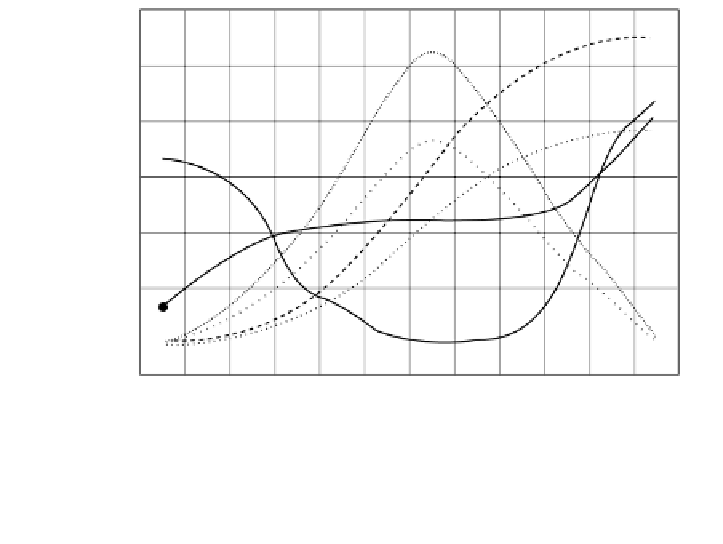
FIGURE 9.5.2
Annual fluctuations of meteorological parameters in the watershed.
9.5.1.1.1.5 Geology and Hydrogeology
Data on the geological and hydrogeological characteristics of the watershed were
gathered from the General Directorate of Mineral Research and Exploration of the
Turkish Republic and the General Directorate of Rural Affairs of the Turkish Repub-
lic (TRGDRA). A 1:10,0000-scaled geological map was used for geological con-
siderations together with a literature review on the springs, hot springs, and ground-
water resources of the area.
There are two major fault lines in the region. One lies to the south of Koycegiz
Lake in a S-SW direction. Sultaniye Hot Spring, with a high level of radioactivity,
is located on it. Velibey, Riza Cavus, and Kokargirme Springs and Hot Springs are
located on another fault line and is separated from the major line. A second major
fault line penetrates through Koycegiz Lake and lies in a NW-SE direction. At the
north of the watershed is a fault line in the NW-SE direction. The locations of major
springs and hot springs are shown in
Figure 9.5.3.
The coastal geological structure of the system permits seawater flow into the
Koycegiz-Dalyan Lagoon. Seasonal groundwater level varies between 0.05 and
6.55 m during May and November. Because of the carstic rock structure of the area,
groundwater resources mainly nourish this lake. Efforts to obtain temporal and spatial
high-resolution groundwater data are ongoing.


Search WWH ::

Custom Search