Geoscience Reference
In-Depth Information
A common identifier—a key—is used to link spatial data with nonspatial attributes. This
method is the most widely used and easiest to implement in a GIS. As long as data sets contain a
common identifier, data sets can be related to each other. Data can be distributed into several small
databases or tables and organized based on convenience. In addition, any data acquired later can be
added into the GIS by adding a common identifier.
The second method used to link spatial data and attribute data is based on the spatial properties
where both data sets share the same spatial properties. This method is useful for relating differ-
ent data layers that contain a spatial property but have no common identifier. For example, to map
soil types within a crop field requires a spatial link, because both data sets do not have a common
identifier. To successfully implement a GIS, one should carefully examine the relationship between
both the spatial and attribute data and select an appropriate method to manage the data layers.
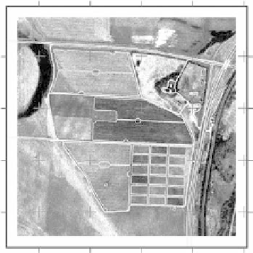
Figure 10.4 shows a series of GIS data layers created for an agricultural test site in Ohio.
-83
.040
-83
.037
-83
.034
-83
.031
-83
.028
-83
.024
-83
.040
-83
.037
-83
.034
-83
.031
-83
.028
-83
.024
181
5690.112
181
7571.772
181
9453.432
323
616.837
323
899.640
324
182.443
324
465.246
324
748.050
181
5690.112
181
7571.772
181
9453.432
323
616.837
323
899.640
324
182.443
324
465.246
324
748.050
fIGURe 10.4
The Management System Evaluation Area (MSEA) site (Ohio) shown in three different stan-
dard map coordinate systems. (Courtesy of S.-S. Lin, pers. comm., 2006.)