Geoscience Reference
In-Depth Information
where F ( ) is the model, and P1 … + (Pn) are the parameters of the model. Unlike traditional meth-
ods, GIS data are organized based on geographic relationships among the data attributes. Areas
that share the same property are grouped into a data layer. The attribute data in GIS layers inherit
the spatial properties of the data. Data modeling is the focus when manipulating layers in a GIS. In
general, the GIS model can be expressed as the following:
F (L1, L2, …, Ln) x,y,z = f (L1)x,y,z + f (L2)x,y,z + … + f (Ln)x,y,z
(10.3)
where F ( ) is the model, and L1 … + (Ln) are the data layers in the GIS.
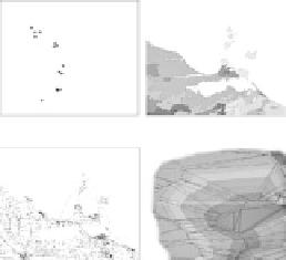
Geographic data, such as the topography of an agricultural field, crop yields, soil type, and
geophysical measurements, are composed of two types of data: the spatial components (x,y) and the
nonspatial attribute data (a). The spatial component stores the position of a feature, and the attribute
data store the property or condition of that particular feature. Geospatial data can be categorized
into four fundamental types—point, line, polygon, and surface—and are stored as either a vector or
a raster format in a GIS (Figure 10.2).
Vector and raster data structures are the two major types of spatial data structures used in a GIS.
A vector data structure is an object-based approach to represent the real world and includes points,
lines, and polygons as spatial objects. A raster data structure is a field-based approach to represent
geographic phenomena that are continuous over a large area.
A vector data format uses a series of points and mathematical functions to describe the shapes
and boundaries of features. For example, a line is composed of two or more points. The polygon is
represented by a series of points that closes at the original starting point. Currently, two types of
vector data models are commonly used in a GIS. These include traditional vector data using Car-
tesian coordinates (the spaghetti model) and a topological vector model. The primary difference
between these two types of vector data models is that the topological vector model adds the topolog-
GIS Data Elements and Characteristics
Vector
Data Types
Vector
-Based on mathematical function
-Point, line, polygon, and surface
Raster
-Data present on a fixed grid
structure (matrix)
-Image, grid
Point
Polygon
Data Characteristics
Lines
Surface
Space
-feature locations
Attribute
-feature attributes,
qualities and characteristics
of geographic places
Relationships between Features
Time
-additional spatial
dimension
Raster
Image
Grid
GIS Data Layers
fIGURe 10.2
The four fundamental data types—point, line, polygon, and surface—in a geographic infor-
mation system (GIS) that can be represented by a vector or raster data structure.