Geoscience Reference
In-Depth Information
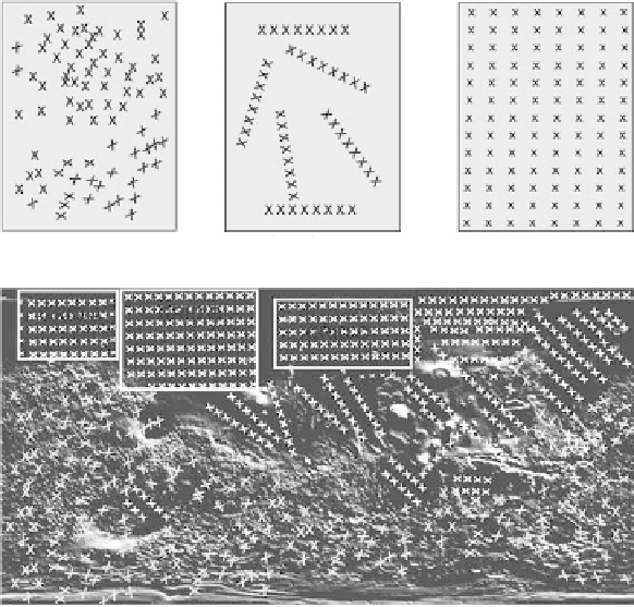
(a) Random station locations
(b) Profile lines
(c) Grid stations
Profile 1
Profile 2
(d) Station distribution in grids, profile lines and randomly in an area with mixed topography
(image modified from htt://ssed.gsfc.nasa.gov/tharsis/shademap.html)
fIGURe 6.9
Station arrangements: (a) random distribution of stations, (b) stations along profile lines, (c) a
grid of stations, and (d) mixed station arrangements in a complex topographic setting.
The fundamental questions that must be asked prior to any survey are as follows: (1) What is the
maximum depth of penetration?, (2) What are the line and trace spacing (horizontal resolution)?,
and (3) What is the resolution needed to achieve the goals of a survey?
6.4.1 M
o d e
of f
s
e n s o R
t
R a n s P o R t
EM system sensors and recording equipment may be hand carried, backpacked, pulled along in
a handcart, or mounted on a vehicle (aircraft, all-terrain-vehicle, or some other type of motor-
ized vehicle). In any case, registering the measurement locations for future reference is one of the
most difficult issues related to any type of field sensor measurements. This may be accomplished
by establishing measurement locations (stations) over a grid or along profile lines, as shown in
Figure 6.9, or by recording a Global Positioning System (GPS) measurement at each station. If the
topography is rugged, or if the landscape is cluttered with trees, roads, fences, or other cultural
features, then it may be necessary to locate stations in pattern that appears to be more-or-less ran-
domly dispersed, as shown in Figure 6.9a. GPS measurements are usually employed to record the
location of dispersed stations. Figure 6.9d illustrates an environment where grids of stations and
profile lines are used in the flat terrain, and randomly dispersed station locations are employed in
the rugged terrain. Measurements along profile lines are often utilized for locating linear features,
such as buried pipes, in the subsurface.
6.4.2 s
t a t i of n
s
P a c i n g
A good rule of thumb for establishing an adequate trace measurement spacing is that the spacing
should be less than one quarter of the size of the smallest object that is to be detected by the survey.