Geoscience Reference
In-Depth Information
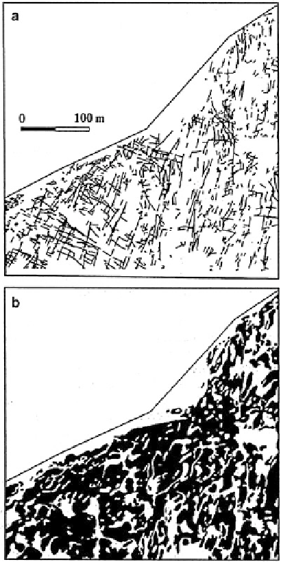
Fig. 11.15 Test area near
AECL Underground
Research Laboratory in the
Lac du Bonnet Batholith
near Pinawa, Manitoba.
(a) Surface fractures;
(b) Outcrop pattern
(in black) (Source:
Agterberg et al.
1996a
,
Fig. 1)
consideration. Several shallow and deep holes had been drilled in the immediate
vicinity of this area selected for the pilot study described in this section. A coupled
surface-borehole study to relate the surface results from the approximately hori-
zontal plane (Fig.
11.15
) to subvertical, linear borehole results was performed later
in a separate study (Agterberg et al.
1996b
; Agterberg
1997
).
Tools developed for numerical treatment of the surface and borehole data for the
Lac du Bonnet Batholith and similar crystalline rocks include: (1) determination
and analysis of fracture intensity measures for boxes of different sizes; (2) analysis
of the precision of the resulting statistical moments; (3) estimation of multifractal
spectra; (4) study of spatial covariances and semivariograms; and (5) spatial fre-
quency distribution analysis. This section is concerned with the first four of these
Search WWH ::

Custom Search