Geoscience Reference
In-Depth Information
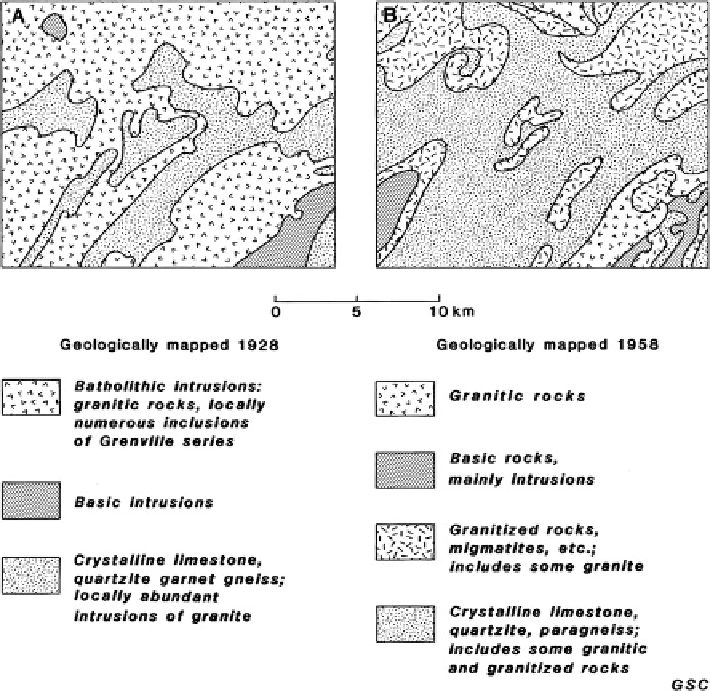
Fig. 1.2 Two geological maps for the same area on the Canadian Shield (After Harrison
1963
).
Between 1928 and 1958 there was development of conceptual ideas about the nature of metamor-
phic processes. This, in turn, resulted in geologists deriving different maps based on the same
observations
geologists that can be bewildering to scientists in other disciplines and to others
including decision-makers in government and industry.
Van Bemmelen (
1961
) has pointed out that the shortcomings of classical
methods of geological observation constrain the quantification of geology. Much
is left to the 'feeling' and experience of the individual geologist. The results of this
work, presented in the form of maps, sections and narratives with hypothetical
reconstructions of the geological evolution of a region, do not have the same
exactitude as the records and accounts of geophysical and geochemical surveys
which are more readily computerized even though the results may be equally
accurate in an interpretive sense. Geophysical and geochemical variables are
determined by the characteristics of the bedrock geology which, in any given
area, is likely to be non-uniform because of the presence of different rock types,
Search WWH ::

Custom Search