Geoscience Reference
In-Depth Information
6000
5000
4000
3000
2000
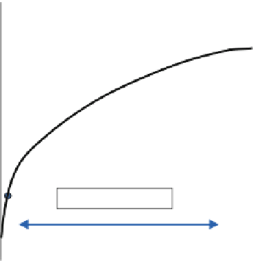
Range - 32 pixels
1000
0
0
10
20
30
40
50
60
lag (pixels)
Fig. 2.31
Semivariogram based on all N-S transects
4. Estimate appropriate variogram ranges for
individual elements (with different variogram
ranges
Shoreface systems generally have long
ranges, at least for their reservoir properties,
and the maximum ranges will tend to be along
the strike of the system;
In braided fluvial systems, local coarse-
grained components (if justifiably extracted
as model elements) may have very short
ranges, often only a nugget effect;
In carbonate systems, it needs to be clear
whether the heterogeneity is driven by diage-
netic or depositional elements, or a blend of
both; single-step variography described above
may not be sufficient to capture this.
Often these generalities may not be apparent
from a statistical analysis of the well data, but
they make intuitive sense. The outcome of an
'intuitive' variogram model should of course be
sense-checked for consistency against the well
data - any significant discrepancy should prompt
a re-evaluation of either the concept or the
approach to handling of the data (e.g. choice of
rock elements). However, this intuitive approach
to geostatistical reservoir modelling is recom-
mended in preference to simple conditioning of
the variogram model to the well data - which is
nearly always statistically unrepresentative.
for
the
horizontal
and
vertical
directions);
5. Estimate the anisotropy in the horizontal
plane;
6. Input these estimates directly to a variogram-
based algorithm if pixel-based techniques are
selected (see next section);
7. Carry through the same logic for modelling
reservoir
properties,
if
variogram-based
algorithms are chosen.
The approach above offers an intuitive route
to the selection of the key input parameters for a
geostatistical rock model. The approach is
concept-based and deterministically steers the
probabilistic algorithm which will populate the
3D grid.
There are some generalities to bear in mind:
There should be greater variance across the
grain of a sedimentary system (represented
by the shorter EW range for the example
above);
Highly heterogeneous systems, e.g. glacial
sands, should have short ranges and are rela-
tively isotropic in (x, y);


