Geoscience Reference
In-Depth Information
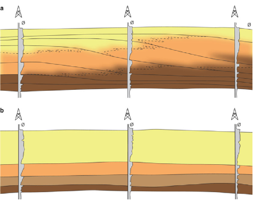
Fig. 2.5
Alternative (a) chronostratigraphic and (b) lithostratigraphic correlations of the same sand observations in
three wells; the chronostratigraphic correlation invokes an additional hierarchical level in the stratigraphy
with a length-scale of kilometres. These sands in
turn act as the bounding envelope for individual
reservoir elements with dimensions of tens to
hundreds of metres.
The reservoir model should aim to capture the
levels in the stratigraphic hierarchy which influ-
ence the spatial distribution of significant
heterogeneities (determining 'significance' will
be discussed below). Bounding surfaces within
the hierarchy may or may not act as flow barriers
- so they may represent important model
elements in themselves (e.g. flooding surfaces)
or they may merely control the distribution of
model elements within that hierarchy. This
applies to structural model elements as well as
the more familiar sedimentological model
elements, as features such as fracture density
can be controlled by mechanical stratigraphy -
implicitly related to the stratigraphic hierarchy.
So which is the preferred stratigraphic tool to
use as a framework for reservoir modelling? The
quick answer is that it will be the framework
which most readily reflects the conceptual reser-
voir model. Additional thought is merited, how-
ever, particularly if the chronostratigraphic
approach is used. This method yields a frame-
work of timelines, often based on picking the
most shaly parts of non-reservoir intervals. The
intended shale-dominated architecture may not
automatically be generated by modelling
algorithms, however: a rock model for an inter-
val between two flooding surfaces will contain a
shaly portion at both the top and the base of the
interval. The probabilistic aspects of the
subsequent modelling can easily degrade the cor-
relatable nature of the flooding surfaces, inter-
well shales becoming smeared out incorrectly
throughout the zone.