Geoscience Reference
In-Depth Information
“
what purpose
”, as the model design will
vary according to that purpose. This section
therefore looks at contrasting purposes of
reservoir modelling, and the distinctive design
of the models associated with these differing
situations.
• To show the
geophysicist
the 3D structural
model based on their seismic interpretations.
Do they like it? Does it make geological
sense? Have seismic artefacts been inadver-
tently included?
• To show the
petrophysicist
(well-log special-
ist) the 3D property model based on the well-
log data (supplied in 1D). Has the 3D property
modelling been appropriate or have features
been introduced which are contrary to detailed
knowledge of the well data, e.g. correlations
and geological or petrophysical trends?
•Toshowthe
reservoir engineer
the geo-model
grid, which will be the basis for subsequent flow
modelling. Is it usable? Does it conflict with
prior perceptions of reservoir unit continuity?
• To show the
well engineer
what you are really
trying to achieve in 3D with the complex well
path you have just planned. Can the drilling
team hit the target?
• To show the
asset team
how a conceptual
reservoir model sketched on a piece of paper
actually transforms into a 3D volume.
1.2
Models for Visualisation Alone
Simply being able to visualise the reservoir in 3D
was identified early in the development of
modelling tools as a potential benefit of reservoir
modelling. Simply having a 3D box in which to
view the available data is beneficial in itself.
This is the most intangible application of
modelling, as there is no output other than a richer
mental impression of the subsurface, which is
difficult to measure. However, most people
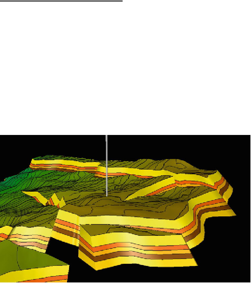
benefit from 3D visualisation (Fig.
1.1
), conscien-
tiously or unconscientiously, particularly where
cross-disciplinary issues are involved.
Some common examples are:
Fig. 1.1
The value of visualisation: appreciating structural and stratigraphic architecture, during well planning