Geoscience Reference
In-Depth Information
(a)
River
Watershed, Río de Aguas
Watershed, Rambla de los Feos
N
Rambla de Sorbas Río
Aguas
de
2 km
Badlands
X
Landslides
>10 m
5
3
>10
3
−
10
m
5
3
<10
3
m
3
X
Capture site
(b)
73
74
75
76
77
78
79
100
13
80
12
60
Surface
lowering
11
40
10
20
09
08
0 (m)
07
S
06
Modern drainage
network
05
80
81
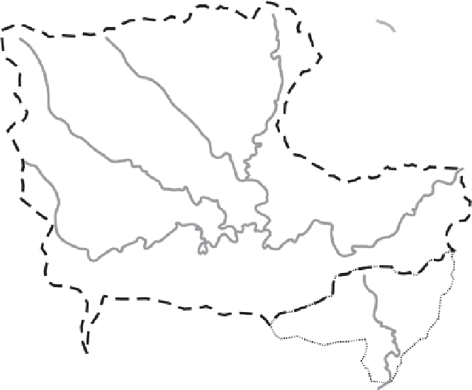
Case Fig. 5.1
(a) Distribution of erosional and landslide features in relation to the 100 ka river-capture site. Note the increase
in frequency and magnitude of landslide occurrences in proximity to the river-capture site, and greater abundance of badland
areas. The box outlines the area depicted in (b). (From Griffiths et al. 2002.) (b) Surface lowering above river-capture site. Note
that the largest amounts of surface lowering are associated with (i) the valley networks, (ii) valley confluences and overall with
(iii) the lower reaches of the drainage network proximal to the capture point. S, Sorbas. (Adapted from Mather et al. 2002.)