Geoscience Reference
In-Depth Information
Analysis of the field data showed great variation
in the surface soil moisture and a difference in
measurement depending on the scale of measure-
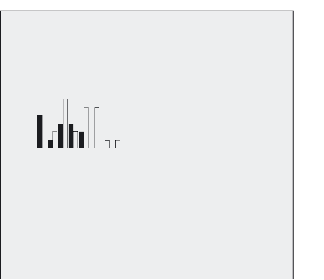
ment (see Figure 4.13). It is evident from Figure
4.13 that the point measurements of soil moisture
are highly variable and that many measurements
of soil moisture are required to try and characterise
the overall field surface soil moisture.
hydrological modelling the scale needed is larger
than point measurements and the spatial inte-
gration of backscatter response may be a way of
getting around highly variable point measure-
ments. When further analysis of the backscatter
response was carried out it showed that inter-
pretation at the pixel size was meaningless and
they needed to be averaged-up themselves. It
was found that the smallest resolution to yield
meaningful results was around 1 hectare (100
100 m).
As with other studies on bare fields (e.g.
Griffiths and Wooding, 1996) there was a reason-
ably good correlation between radar backscatter
and measured soil moisture. Unfortunately, this
relationship is not good enough to provide more
than around 70 per cent accuracy on estimations
of soil moisture. In addition to this the study was
carried out in conditions ideally suited for SAR
interpretation (flat topography with no vegetation
cover) which are far from atypical conditions
encountered in hydrological investigations.
Overall it is possible to say that although the
satellite remote sensing of soil moisture using
SAR may offer some advantages of spatial inte-
gration of the data it is not enough to offset
the inaccuracy of estimation, particularly in non-
flat, vegetated catchments. There may come a time
when satellite remote sensing can be used as a
replacement for field measurements, but this will
be in the future.
7
6
5
4
3
2
1
0
Intensive
Large scale
0.1
0.12 0.14 0.16 0.18
0.2
0.22 0.24 0.26 0.28
0.3
0.32
Theta
Figure 4.13
Measured surface soil moisture
distributions at two different scales for a field in
eastern England in October 1995.
In contrast to the directly measured soil mois-
ture measurements, the microwave backscatter
shows much less variation in response (see Figure
3, p. 330 of Davie
et al
., 2001). The most likely
explanation for this is that the spatial averaging
of backscatter response within a pixel (25
25m
in this case) evens out the variations found
through point measurements. This can be thought
of as a positive aspect because in many cases for
between the two is in the mass of water held and the
duration of storage (Lundberg and Halldin, 2001).
The amount of intercepted snow is frequently
much higher than for rainwater and it is held for
much longer. This may be available for evaporation
through sublimation (moving directly from a solid
to a gas) or release later in snow melt. Hedstrom
and Pomeroy (1998) point out that the mass of
snow held by interception is controlled by the tree
branching structure, leaf area and tree species.
In countries such as Canada and Russia there are
SNOW AND ICE
Snow and ice are hugely important stores of water
for many countries in the world, particularly at high
latitudes or where there are large mountain ranges.
The gradual release of water from snow and ice,
either during spring and summer or on reaching
a lower elevation, makes a significant impact on the
hydrology of many river systems.
In the same manner that rainfall may be inter-
cepted by a canopy, so can snow. The difference


