Geoscience Reference
In-Depth Information
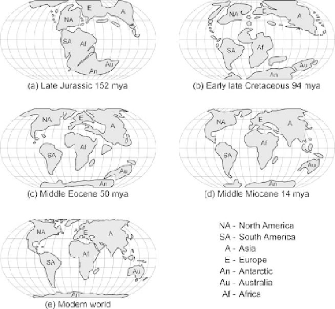
Figure 2.3 Plate tectonic movement as it relates to Gondwana.
(Illustration by Jeff Dixon.)
The large landmass that once contained the tropical rainforests of South
America, Africa, Madagascar, Southeast Asia, India, Australia, and New Guinea
was part of the southern half of the supercontinent Pangaea. Pangaea remained
centered along the Equator from the Triassic to the mid-Jurassic Period (240-160
mya). During this time, the continental blocks that form the core of Southeast Asia
are thought to have separated from the supercontinent. As tectonic plates contin-
ued to shift, Pangaea began to break apart, and northern and southern landmasses
were formed. The southern landmass containing Africa, India, Madagascar, South
America, Australia, and Antarctica was called Gondwana (Gondwanaland). The
more northern landmass containing North America and Eurasia was called Laura-
sia (see Figure 2.3). Laurasia moved away from the Equator to the northeast in a
counter-clockwise motion. Gondwana remained along the Equator, experiencing
high sun, high heat, and abundant rainfall near the coasts and continued to provide
ideal conditions for the evolution of the Tropical Rainforest. The time and relative
tectonic stability within Gondwana allowed the area to develop intricate and com-
plex ecosystems.
Gondwana began to slowly separate; South America, Antarctica, Australia,
and New Guinea began to move south and eastward due to the formation of the