Geoscience Reference
In-Depth Information
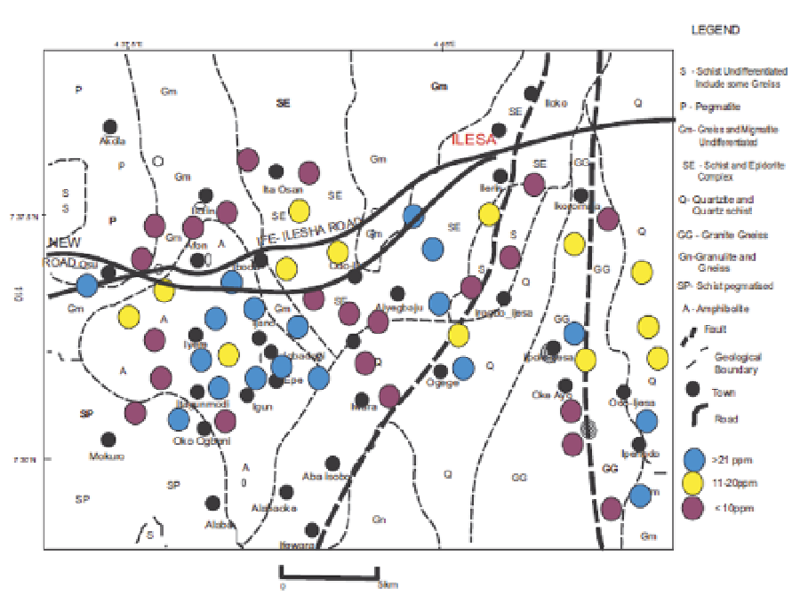
Fig. 4. Map showing the association ratio of Pb - Cr in the study area.
5.2 The electrical resistivity data, analysis and results
Electrical methods are generally referred to as “resistivity surveys”. Metallic minerals are
relatively good conductors of electricity. In contrast, common rock forming minerals are
generally poor conductors. This fact is the basis for geophysical exploration methods which
measure conductivity to evaluate the metal content of rocks. The methods also provide
some limited information about the geometry of the subsurface metallic mineralization.
Surface electrical methods are limited to shallow depths (<200m), but the electrical
properties of rocks can be measured at much greater depths by using electrical borehole
instruments sent down deep drill holes. The location of the seven (7) VES data points are as
shown in Figure 6. They are located so as to provide subsurface geological information
including, layer resistivity, thickness and depth to the bedrock which will be useful in the
geophysical modeling that will follow in the subsequent section. The Wenner configuration
was used with electrode separation (a) varying from 1 - 96m. VES curves were interpreted
using the partial curve matching technique followed with computer iteration procedure on
the WinGLink computer software version 1. 62. 08. On this software, computed curves are
compared with observed field curves. Where a good fit (i. e. 95 % correlation and above)
was obtained between the two curves, the interpretation results was considered satisfactory;
otherwise the geoelectric parameters were modified as appropriate and the procedure
repeated until a satisfactory fit was obtained. The result from the computer iteration is as
summarized with their geoelectric parameters in Table 5.
Search WWH ::

Custom Search