Geoscience Reference
In-Depth Information
The local Hölder exponent (or local regularity) maps obtained from the GR data recorded in
the K, Th and U channels, using a multiple filter technique that we generalize to a 2D-case,
exhibit almost an identical image. Besides, they allow to locate the faults affecting the
studied zone.
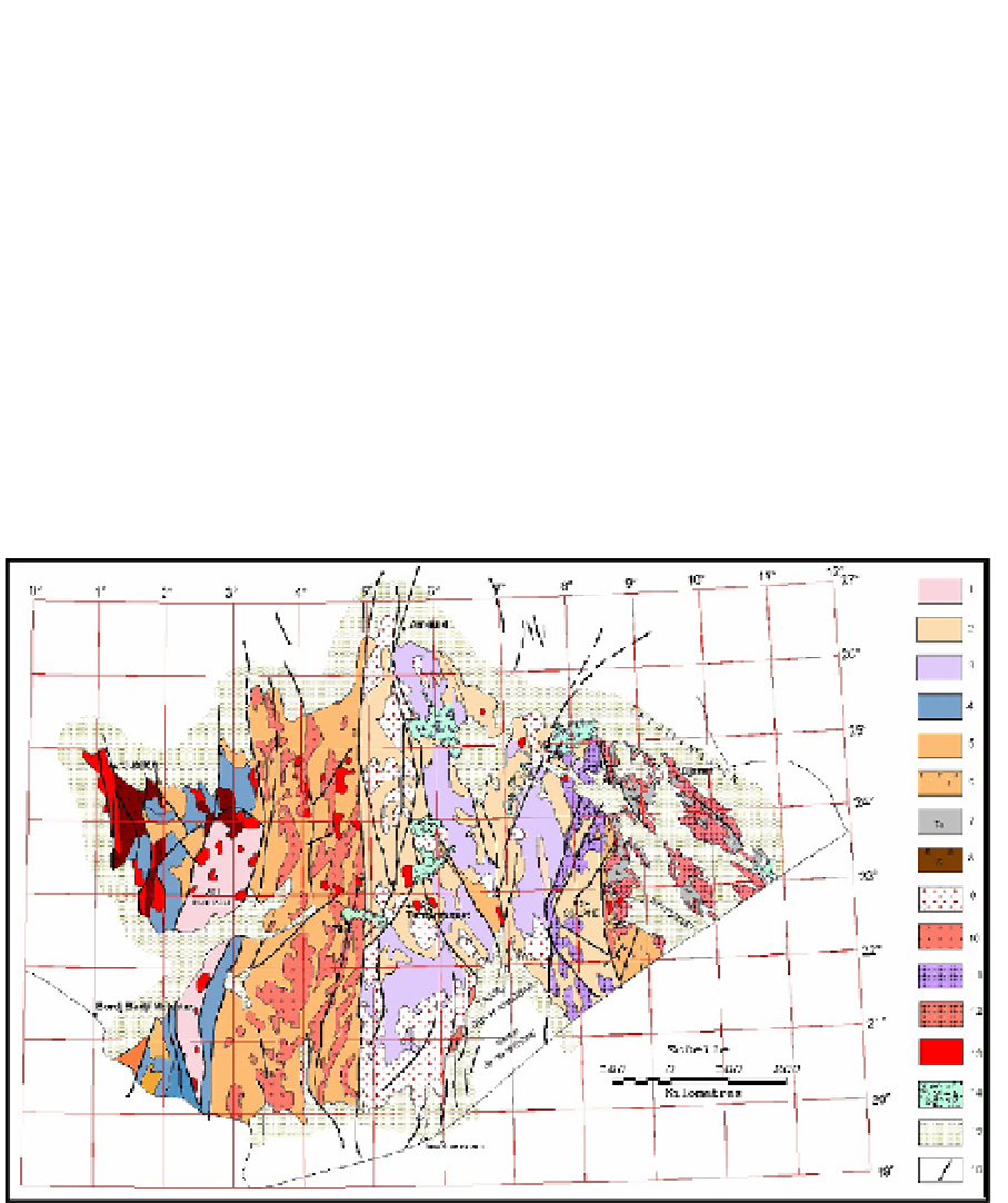
2. Regional geology
The Hoggar is a large shield area covering approximately 550,000 km
2
. It includes an
important surface of the Tergui shield, prolonged in South-east, in Mali, by the solid mass of
Iforas and in the East, in Niger, by the solid mass of Aïr (Fig. 1).
The Hoggar belongs to the Trans-Saharan pan-African chain (Cahen
et al.
, 1984, Liégeois
et
al
., 1994). It is crossed by two major submeridian faults, located at longitudes 4°50' and 8°30',
which delimit three longitudinal compartments (Eastern, Central and Western), with
different structural and lithological characteristics. This geological configuration resulted by
an extreme E-W compression, during the pan-African (600 My), of the Touareg shield by
two rigid plates: the Western African craton and the Eastern African craton (Bertrand and
Caby, 1978; Black
et al.
, 1979).
Western Hoggar
Central Hoggar
Eastern Hoggar
1
- Archaean granulites;
2
- Gneiss and metasediments, series of Arechchoum (Pr1);
3
- Gneiss with
facies amphibole, series of Aleskod (Pr2);
4
- Indif. gneiss (Pr3);
5
- Pharusian Greywackes;
6
- Arkoses
and conglomerates, series of Tiririne (Pr4);
7
- Volcano-sediments of Tafassasset (Pr4);
8
- Molasses
(purple series) of Cambrian;
9
- Pan-African syn-orogenic granites;
10
- Pan-African Granites;
11
- Pan-
African post-orogenic granites;
12
- Granites of Eastern Hoggar;
13
- Late pan-African Granites;
14
- Basalts and recent volcanism;
15
- Paleozoic cover;
16
- Fault.
Fig. 1. A simplified geological map of the Hoggar (Caby
et al.
, 1981, modified)
Search WWH ::

Custom Search