Geoscience Reference
In-Depth Information
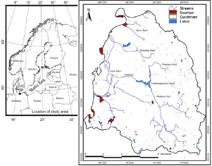
Fig. 19.1
Catchment area at Wismar Bay
evapotranspiration (Haude
1955
) is calculated as 575 mm/a. The land use is crop
farming on loamy soils and forestry on sands.
Three approximately 10 m thick aquifers are built by glaciofluvial sands of
Saalian and Weichselian age. They are separated by up to 20 m thick glacial till
layers which locally pinch out. The uppermost aquifer is partly phreatic. Hydraulic
gradients of up to 0.5% are slightly steeper than reported for northeast German
conditions (Jordan and Weder
1995
).
19.4 Model Assumptions and Results
19.4.1 Groundwater Recharge
Given today's climatic conditions, groundwater recharge is estimated as 145 mm/a,
i.e. 24% of the average annual precipitation rate of 600 mm (non-corrected). This
value is representative for the area which is dominated by arable land and forests
on loamy and sandy soils. Assuming that land use will not change, groundwater
recharge will vary according to changes in precipitation. Based on the predictions