Geoscience Reference
In-Depth Information
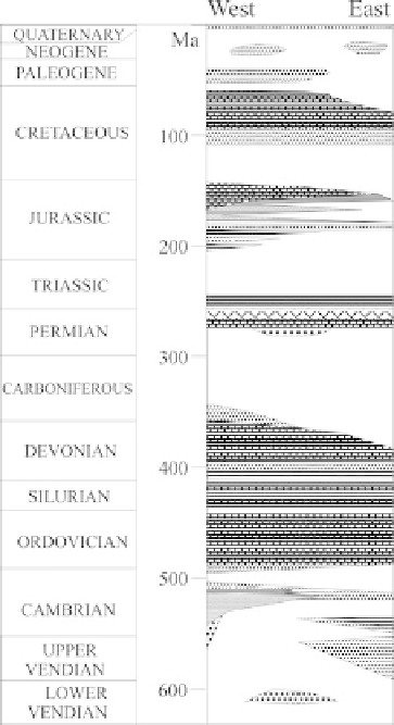
Fig. 2.5
Ediacaran-Phanerozoic
chronostratigraphic chart of
the Baltic basin
2.2.2 The Southwestern Basin Rim
The southwesternmost part of the Baltic basin, west of the Tornquist zone (southern
Møn, Falster, Lolland, Rügen and Usedom islands), is located in a different tec-
tonic setting and forms the bordering area between the North German basin and
the Baltic basin. The area is characterized by an Early Palaeozoic thrust and fold
belt which forms part of the Danish-North German-Polish Caledonides (Piske and
section of the area is known only from the results of a few oil and gas exploration
The borehole G14 which is located 36 km east-northeast of Arkona (northern
tip of Rügen Island) and north of the Caledonian deformation front drilled into
intensely altered granite which was dated to around 1450 Ma using the U/Pb dating