Geoscience Reference
In-Depth Information
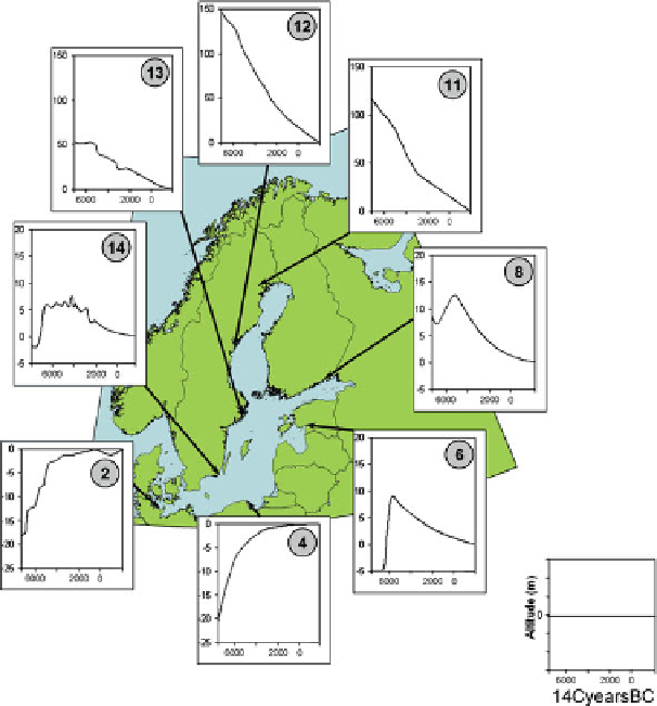
Fig. 15.1
An assortment of relative sea-level curves around the Baltic Sea during the Phase of the
Littorina Sea (7,000 BC - after Rosentau et al.
2007
, fig. 4)
thumb especially in the northernmost parts of this countries is 'the higher the level,
the older the site' (Figs.
15.1
and
15.6
).
The growing amount of relevant data obtained from new investigations over the
last few decades, especially in Norway and Sweden, has led to a large number
of regionally valid sea-level curves, which permit the generation of shoreline-
displacement models of increasingly high quality (Rosentau et al.
2007
). This new
information about shoreline developments has, in some cases, already had important
consequences for the archaeology-based reconstruction of the settlement history and
led to changes in the research strategy.
The history of Stone Age settlement in northern Sweden can be mentioned as
an example (Hörnberg et al.
2005
). The glacio-isostatic land uplift there created
a dynamic landscape that experienced a great deal of substantial environmental
change during the Holocene such as the relocation of lake shorelines and modifica-
tions of the water flow in rivers. Consequently, the present landscape is completely
different from that in the past. For a long while, only a few Stone Age sites were