Geoscience Reference
In-Depth Information
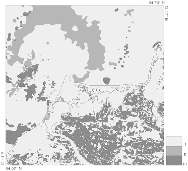
Fig. 14.4
Simplified sedimentological surface model of the Darss-Zingst region. Recent coastline
is marked by the
solid black line
. Sediment types: (I) sand, (II) very fine sand and mud, (III) glacial
till
Internally, Sedsim requires information about the sediment composition for each
model cell, based on a system of four grain size classes. These are coarse, medium,
fine, and silt classes with parameters adjustable in the Sedsim command file. The
grain properties influence the results in several ways. Denser and larger particles are
harder to erode, so that once finer particles have been removed from the top layer of
a particular grid cell, the coarser particles may shield the cell from further erosion.
Coarser particles are also able to reside at a much steeper submarine angle than the
fine particles (a user-defined parameter). The result of this is that fine material tends
to be eroded easier and transported further. This results in a more sand-rich coastline
and a more mud-rich deep marine environment.
A conversion of the sediment map according to the scheme shown in Table
14.1
the Usedom peninsula, ca. 100 km east of the Darss-Zingst region, but genetically
similar.
Such a sediment distribution can only be acquired for the terrain surface and
detailed data about the vertical distribution of sediments are rather rare. For the
Darss-Zingst region no consistent 3D model of the sediment structure with a satisfy-
ing spatial resolution is known. Therefore, as a general presumption the thickness of