Geoscience Reference
In-Depth Information
Narva-Jõesuu. The water depth is modest (about 2-4 m) in the vicinity of the sea-
ward end of the breakwater, where the sand bar is highest. The water depth increases
considerably upstream, reaching 8-10 m at the natural river mouth, and increases
seawards to 10 m about 2 km offshore. The flow in the mouth of the Narva River can
over the sill is mostly driven by the discharging river, and the longshore transport
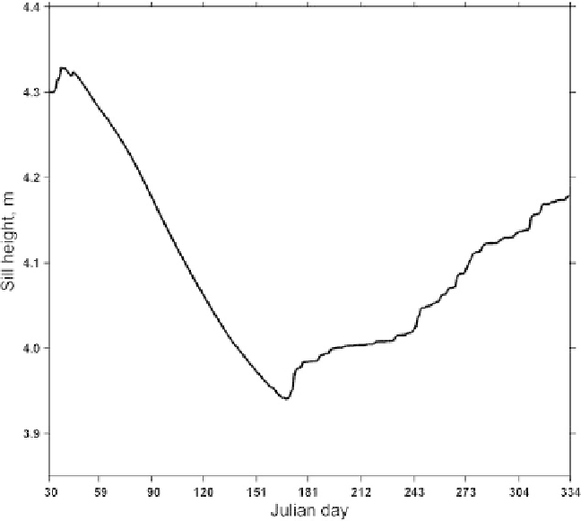
by waves. The comparatively slow changes in sill height can be treated, as a first
approximation, as a nearly balanced situation between the cross- and longshore
transport.
The observed hydrological conditions and the estimated hydraulic parameters
suggest that the straightforward, one-layer hydraulic model fails to adequately
describe changes in the bottom topography of the river mouth. Hence, a two-layer
observed stratification in the river mouth area. The observed spatial salinity dis-
tribution confirms that the river plume extends far into the bay during the spring
months when the river discharge is comparatively large and the flow has a two-layer
nature. During the autumn and winter months the river mouth is mainly stratified.
Fig. 13.9
Modelled variation of the sill height at the seaward end of the Narva-Jõesuu breakwater.