Geoscience Reference
In-Depth Information
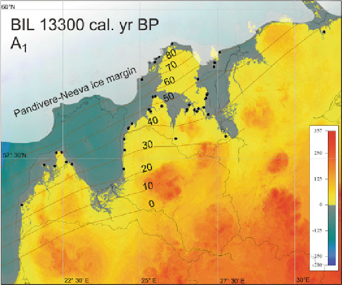
Fig. 9.2
BIL 13,300 cal. years BP, stage A
1
. Isobases show the reconstructed water level above
present sea level in metres.
Black dots
show the location of used shoreline sites
9.3.2 BIL 12,700 cal. years BP (A
2
)
During the Palivere stade, BIL covered ice-free areas of Estonia, Latvia, Lithuania
10-15 m lower in northern Estonia and only a few metres lower in southern Estonia
and Latvia. Water level near SW Lithuanian coast and further south was below
present sea level. The main connection between BIL in Baltic Sea basin and Glacial
Lake Peipsi was located in northern Estonia. The strait in southern Estonia via Lake
Võrtsjärv still existed, but it was considerably narrowed. Reconstruction indicates
9.3.3 BIL 12,200 cal. years BP (BI)
During the standstill of ice margin at Salpausselkä I BIL stage BI, waters cov-
ered southern Finland, western Estonia and coastal areas of Latvia and NW Russia
coast and further south it was below present sea level. During the ice retreat from