Geoscience Reference
In-Depth Information
spatial dependencies of variables mirroring the complex structure, a coastal 4D GIS
is used for this study.
7.2 Area of Investigation
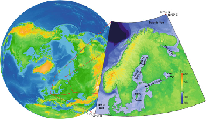
Figure
7.1
shows the Baltic Sea as a semi-enclosed marginal sea surrounded by the
Scandinavian Caledonides and the Fennoscandian Shield in the north, the Russian
Plate in the southeast, and the Northeast-German Depression in the south and
southwest. The Baltic area including the sea basin was shaped by the Quaternary
glaciations: glaciers have abraded the Baltic Sea Basin (water depth 55 m on aver-
age) forming several separate sub-basins and shallower sills. Within the Baltic
Basin and along its southern coastlines Weichselian glacial deposits form the main
sources for the Late Pleistocene and Holocene sediment formation. The Baltic Sea
is connected with the North Sea through the Belt and the Sound which serve as a
“bottleneck” for the water exchange with the world ocean.
The type of coasts around the Baltic Sea depends on the geological structures and
the geotectonic setting. Fjord-like coasts and sea bottom coasts (Gulf of Bothnia)
as well as archipelagos (northern Gulf of Finland, East Sweden) prevail at the
Fennoscandian Shield built up by Proterozoic crystalline bedrock. At the southern
Gulf of Finland and the Estonian coast, cliffs can be found, built from Palaeozoic
sediments, whereas in the southern Baltic Sea, moraine cliffs and sandy Holocene
spits and lowland coasts are dominating.
Fig. 7.1
Relief map of the rigid earth (Digital Elevation Model - DEM
0
) for the Baltic Sea area.