Geoscience Reference
In-Depth Information
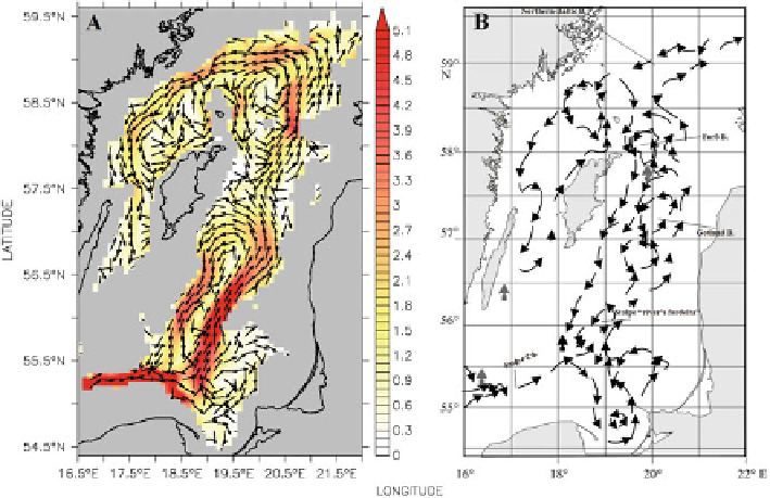
Fig. 5.4 a
Current field within the Baltic Proper, water depth: 60 m, mean value from modelling
currents (beneath the halocline). Paleoreconstruction by Emelyanov
(
2006
)
on the basis of Littorina
mud thickness and proxies for resuspension and redistribution of sediments
5.3 Methodology
For the solution of the scientific task a special methodology elaborated mainly in
a spatial/temporal model of the basin fill under investigation based on measured
data. These data derived from geophysical surveying and measuring of samples
from sediment cores (facies variables) have to be connected spatially (interpola-
tion) and allocated to the time of sediment formation. Coring sites were selected
based on sediment profiling (sediment echosounder). The so-called master stations
play a key role, representing the development of the basin through continuous sed-
imentary records. The variables can be measured for different cores taken at the
master station, which later on are combined for a “composite” sediment sequence
describing the master station. Continuously measured data sets ordered linearly
along the sediment sequence within the cores are grouped according to the similar-
ity of facies using multivariate classification methods. Contiguous samples showing
a similar facies are put together to facies zones. This procedure is called “zona-
tion” and defines core depth boundaries between lithostratigraphic units. These
depth boundaries have to be converted to age data. Different dating methods for