Geoscience Reference
In-Depth Information
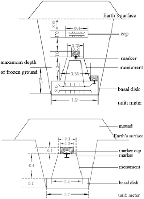
Fig. 3.17 Fundamental
benchmark
Fig. 3.18 Ordinary
benchmark
Apart from leveling as the primary method for establishing vertical control
networks, one can also employ trigonometric leveling and GPS measurement to
obtain the height of a surface point. The latter two methods prove to be faster for
establishing networks. The major flaw, however, lies in their lower accuracy
compared to precise leveling.
3.3 The Three-Dimensional Coordinate Datum
and Satellite Geodetic Control Networks
Similar to classical horizontal and vertical control networks, the satellite geodetic
control network also consists of a series of geodetic control points on the Earth's
surface in the form of a network. The difference lies in that through establishing a
satellite geodetic control network, one can directly obtain the three-dimensional
coordinates of control points, indicating realization of the three-dimensional geo-
detic datum. Therefore, the techniques used to establish control networks should be
Search WWH ::

Custom Search