Geoscience Reference
In-Depth Information
Fig. 3.12 Outside
appearance of the leveling
origin in China.
Source: SBSM
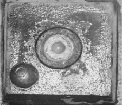
Fig. 3.13 Surface of the
leveling origin mark in
China. Source: SBSM
known as Valdai), the US imported SUTRON9000 automatic water gauges, and the
SCA6-1 acoustic water level meter produced by the Research Institute of Technol-
ogy, State Oceanic Administration. The water levels are observed three times a day
at 07:45-08:00, 13:45-14:00, and 19:45-20:00. The tidal records obtained over
years are measured and analyzed rigorously to calculate the sea level at the Qingdao
tide gauge station. It is 2.429 m, which is considered the national vertical datum.
In 1959, China promulgated the Guidelines for Geodetic Surveying in People's
Republic of China prescribing that “the height of the national benchmark is
calculated relative to the leveling origin at Qingdao. According to the result
computed in 1956, the height of the origin was designated 72.289 m above the
Huanghai mean sea level.” This reference surface is generally called the “Huanghai
Mean Sea Level 1956.”

Search WWH ::

Custom Search