Geoscience Reference
In-Depth Information
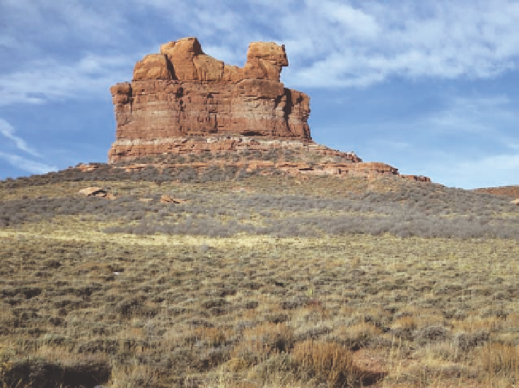
Fig. 17.10. chimney Rock, also known
as camel Rock, on the Wyoming-
colorado border, southwest of Laramie.
the upper part is being carved from
casper sandstone, the base from Foun-
tain sandstone. Black sagebrush grows
on the sandy soil in the foreground.
this photo was taken in mid-november,
after the deciduous shrubs had lost
their leaves. the light gray shrub on
the gentle slope is true mountain-
mahogany, and the darker shrub on the
steep slope next to the base is skunk-
bush sumac. elevation 7,700 feet.
apparent, with foothill shrublands of true mountain-
mahogany and black sagebrush at lower elevations.
At mid-elevations, on south slopes, scattered limber
pines and a few ponderosa pines grow with an under-
story of mountain-mahogany. on north-facing slopes
at the same elevation, dense forests of limber pine and
Douglas-fir are found, such as east of Laramie along
interstate 80 passing through telephone canyon. Far-
ther up the canyon, forests or woodlands are found on
both slopes. At the summit, such as near Lincoln Monu-
ment, small stands of lodgepole pine, subalpine fir, and
engelmann spruce can be found on north slopes; limber
pine savannas occur elsewhere.
trees rarely grow in the lowlands, except in riparian
zones and in association with outcroppings of rock (fig.
17.11). Plausibly, the boulders and exposed soil provide
favorable microenvironments for the establishment of
tree seedlings, absorbing heat during the day that mod-
erates cold temperatures at night. Also, there may be
less competition from other plants in such places, and
the boulders and ridges may provide leeward environ-
ments where snow drifting occurs, thereby providing
more water. Moreover, when it rains, the water flows off
the rock surfaces into cracks or into the soil under the
rocks, where evaporation is minimal, which provides
a longer-lasting source of water. essentially, the rocks
funnel moisture into places where roots concentrate.
Both ponderosa pine and limber pine grow in such
microenvironments. evidence indicates that the pines
existed in such places about 6,000 years ago, when the
as now, mixed-grass prairie grew over most of the
basin floor.
Riparian woodlands, shrublands, meadows, and
hayfields currently cover about 10 percent of the low-
lands (figs. 17.12 and 17.13). Such a large proportion
of the landscape in riparian vegetation is unusual for
Wyoming and is attributable to flood irrigation (see
in depressions, sometimes in association with saline
shales, salts tend to accumulate on the soil surface,
even to the point of forming a white crust (see chapters
5 and 8). only halophytes survive in such areas, includ-
ing greasewood, saltbush, red swampfire, alkali saca-
ton, and saltgrass (about 4 percent of the basin floor)
(fig. 17.14). Where water persists, small lakes develop,
with playa wetlands having bulrushes, spikerushes,
wetlands, marshes, and associated lakes and ponds
are the core of three national wildlife refuges in the
basin, namely, Bamforth, Hutton Lake, and Mortenson
Lake. Water diversions from Sand creek to some of the
Search WWH ::

Custom Search