Geoscience Reference
In-Depth Information
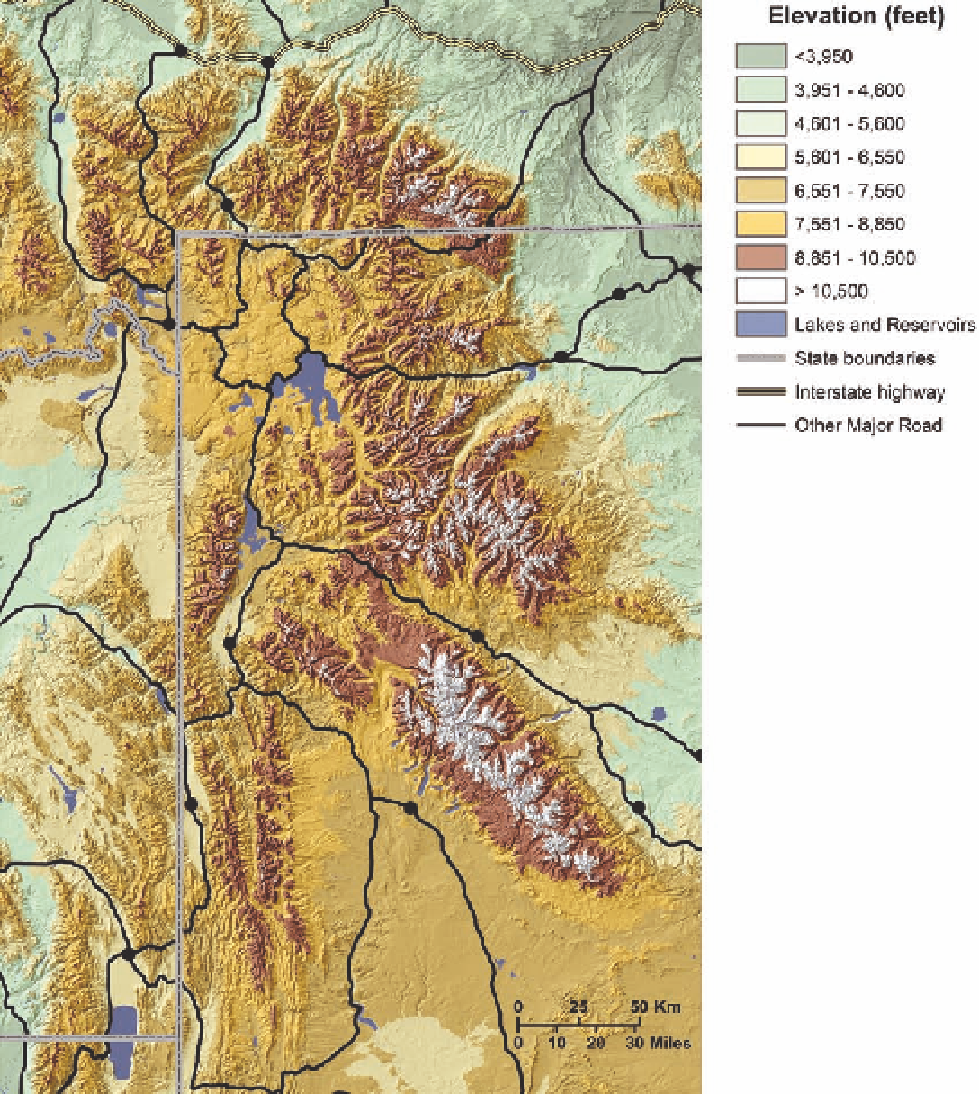
Fig. 15.1. elevation map for the Greater
Yellowstone ecosystem. See fig 1.3 for a
map showing land under the jurisdiction
of different agencies, and fig. 1.5 for the dis-
tribution of different kinds of vegetation in
the area. the land area covered by this map
is about 50,000 square miles. cartography
by Ken Driese.
know this remnant is part of the same Flathead sand-
stone that now lies about 6 miles below the valley floor.
Slippage along the fault continues at about 12 inches
per century in some places, with the valley floor sink-
rise above 12,000 feet, with Grand teton the highest
at 13,770 feet. nowhere else in the Rocky Mountains is
there such an abrupt rise in elevation—6,500 feet from
the bottom of Jackson Hole to the top of Grand teton (fig.
15.3). As expected for a mountain range created along a
fault line on the east side, the west slopes are gentler and
are still covered by sedimentary strata (fig. 15.4).
With regional uplifting, continental cooling, and cli-
mate change, glaciers crept over the Yellowstone region
and then retreated numerous times (see chapter 2). the
most recent glaciation, known as the Pinedale, began
Search WWH ::

Custom Search