Geoscience Reference
In-Depth Information
6.5.1
. A summer case
A summer case on 6 June, 2004 is shown in Figs. 11(a)-11(c). On this day
the precipitation was as much as 61 mm, and the onset of the rainy season
was announced. From Fig. 11(b), a large amount of precipitation occurred
during 16:00 and 18:00 with low cloud height. The rain stopped after 19:00.
The wind direction changed from SE
E
NE
N. There was observed
→
→
→
frequent jumps of the cloud bottom height.
6.5.2
.Awintercase
As an example in winter, a case in 4 January, 2005 is shown in Fig. 12. In
Fig. 12(a), the vertical profile up to 10 km is shown. In the morning, cloud
decreases the altitude suddenly from 10 to 1 km; then the cloud disappears
and sunshine appears. Around 16:00, the wind direction changes from SW
to NNE, and the temperature lowered sharply. Also, the relative humidity
decreased from 80% to 30% due to the intrusion of cold, dry air. During
22:00 to 23:00, it is found that the raindrops evaporate even before reaching
the ground.
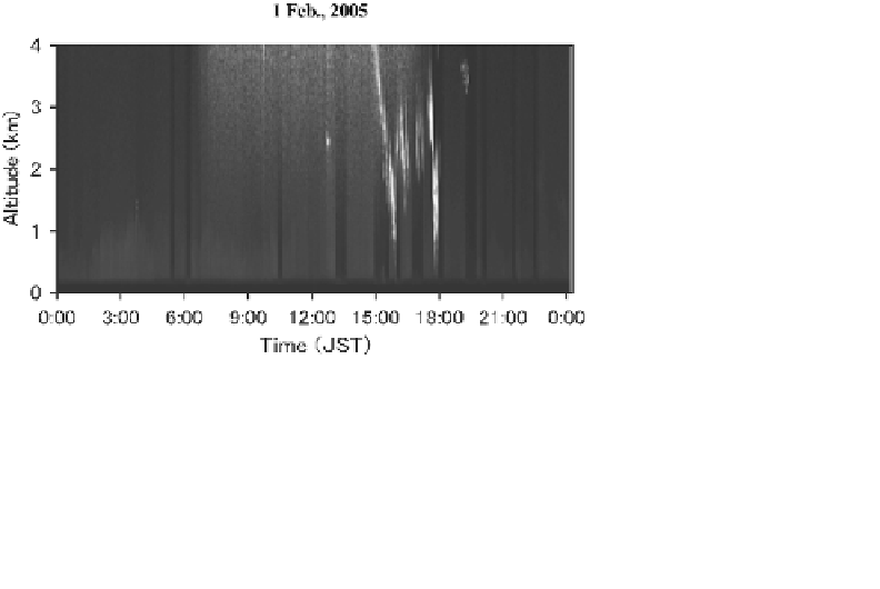
6.6
. Sudden change of cloud height
An example of sudden decrease of cloud height has already been mentioned
in association with the frontal passage (Sec. 6.5). Similar phenomena
are seen under different circumstances. Figure 13 shows a case in winter
Fig. 13.
An example of sudden change of cloud height observed on 1 February, 2005.