Geoscience Reference
In-Depth Information
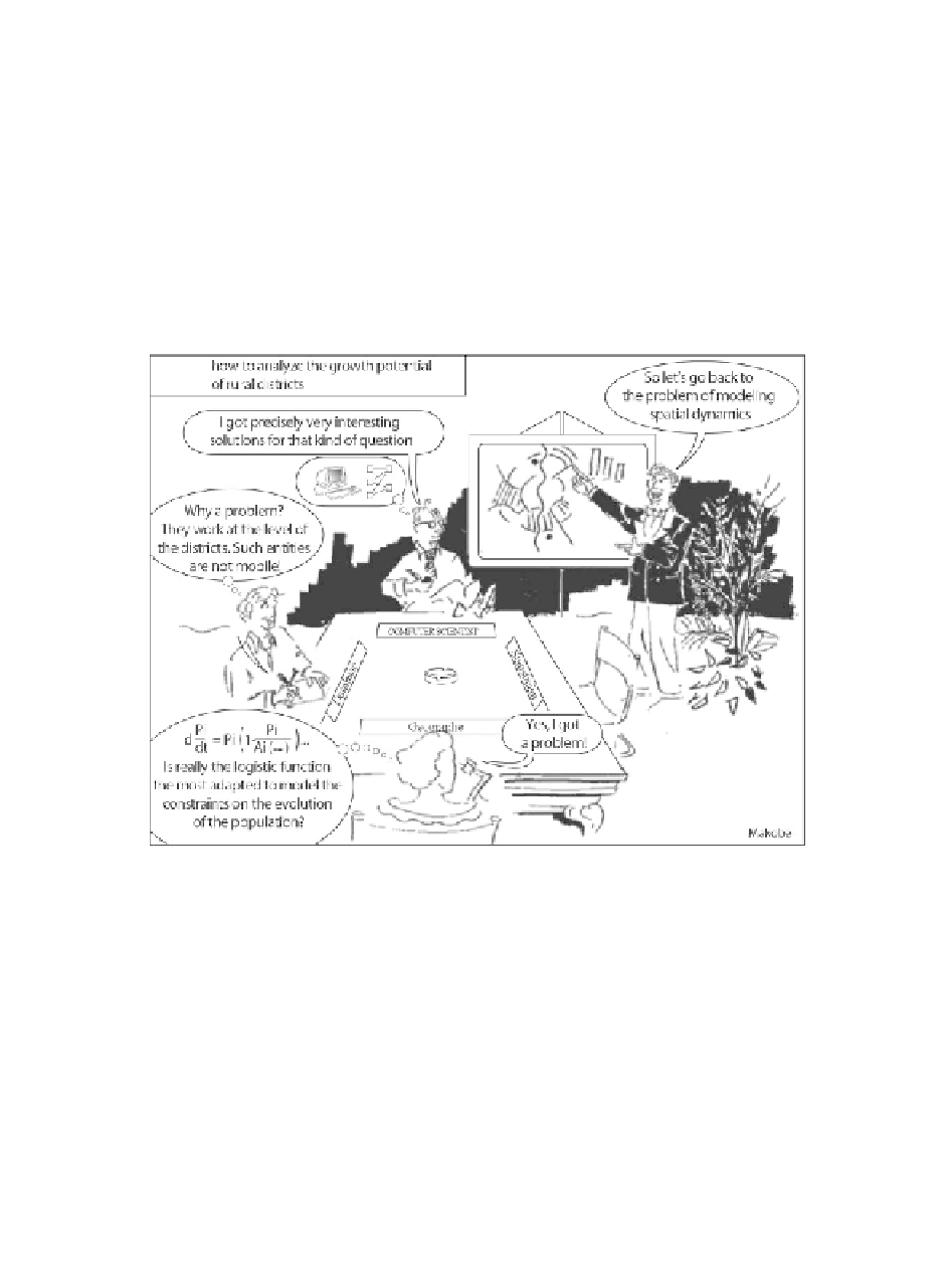
whose purpose is to analyze “the potential for growth of rural municipalities” in
France and the speaker mentioned “the problem of modeling spatial dynamics”.
Everyone hears the same sentence, but the interpretation is rooted in disciplinary
practices: the geographer-modeler raises questions about the form of the process at
the origin of the growth differentials between the municipalities; the geomatician,
questioning the data model, identifies here a very simple case, the objects being
clearly identified and their location and geometry being fixed over time; the
computer scientist imagines a structure allowing queries on the growth rates of
municipalities. “Modeling spatial dynamics” does, therefore, have a meaning for
each one, but these meanings differ, without being in contradiction. They are simply
referring to different modeling challenges. The problem is that each of the
participants does not always anticipate the different meaning given by the other.
Figure 2.3.
Models and interdisciplinarity
A second example enables specifying the forms of the dependence of the
representations on the disciplinary background. This time, the question is about
“modeling the dynamics of a landscape” and two actors are in play, a geographer
and a geomatician:
- The geographer thinks about the regularities in the change of land use: what
role does the distance to the closest city plays in this change? And the economic and
social profiles of this city? How can the role of the actors be formalized (individual