Geoscience Reference
In-Depth Information
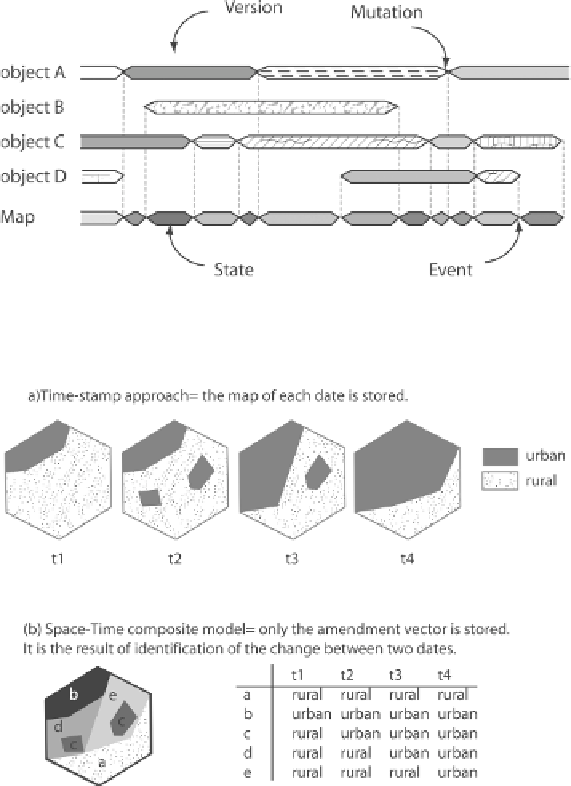
decomposed into elementary polygons according to a principle of uniqueness of
history. The elements constructed that way have stable geometries in time.
Figure 1.7 illustrates these elements in the case of a city's morphological extension.
The different states of the city in time will be described by a series of polygons of
built-area: the historical center by t0, the center and the first periphery by t1 and so
on for the different urbanized peripheries. However, the elements formed (called
“amendment vectors”) have no meaning
a priori
: they are simply associated with a
story.
Figure 1.6.
The relationships between map states and object versions
(according to [LAN 88])
Figure 1.7.
The space-time composite data model (according to [LAN 88])