Geoscience Reference
In-Depth Information
(a)
35
ºS
36
174
176
ºE
(b)
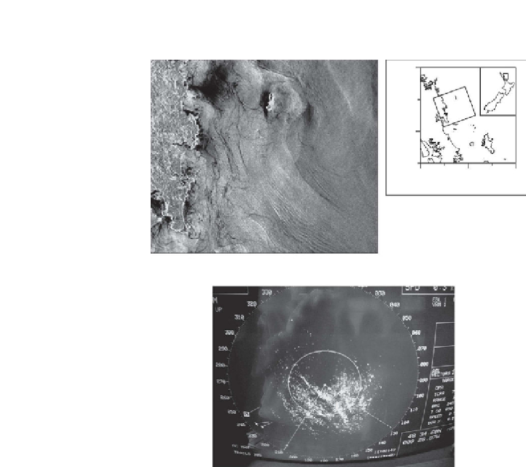
Figure 10.13
(a) Synthetic Aperture Radar (SAR) image off the northeast New Zealand shelf;
the map to the right shows the area of the image. From Sharples et al.,
2001a
, courtesy the
American Geophysical Union; (b) A photograph taken of the radar screen aboard RRS
Charles Darwin during a research cruise to the shelf edge of the Celtic Sea in July 2005. The 3
targets in the left of the screen in (b) are fishing vessels, approximately 6 km from the RRS
Charles Darwin.
driven by the barotropic tide, they are not always in a consistent phase relation
with it. To date, there seems to be no general explanation for the intermittency
and spatial variability of the baroclinic tides, although it may be related to the low
phase velocity of the internal modes which allows the barotropic tidal flow and
other currents to significantly modify the propagation of the tide. Changes in the
stratification will also act to modify the propagation speed away from the


Search WWH ::

Custom Search