Geoscience Reference
In-Depth Information
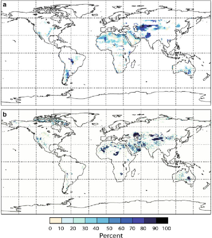
Fig. 9.1
Prescription of enclosed topographic depressions as preferential sources for dust emis-
sion based on a 1
ı
1
ı
topography map used by Ginoux et al. (
2001
)(
a
) and based on a water
routing and storage scheme (Coe
1998
) used by Tegen et al. (
2002
)(
b
). The
colour scale
indicates
the percentage of the grid cell acting as a preferential dust source
Due to the difficulties in determining the location of dust sources in particular
for the Saharan desert, satellite retrievals from polar-orbiting satellite instruments
(including the A-Train instruments Moderate Resolution Scanning Radiometer
(MODIS), Multi-angle Imaging Spectroradiometer (MISR) and Ozone Monitor-
ing Instrument (OMI)) or instruments on geostationary satellites (e.g. Spinning
Enhanced Visible Infrared Imager (SEVIRI) on the Meteosat Second Generation
satellite) are often used to identify dust source areas (Schepanski et al.
2007
;Draxler
Search WWH ::

Custom Search