Geoscience Reference
In-Depth Information
26,
2004
was
well
recorded
by
the
pendulums
(Braitenberg et al.
2006
).
3.2.4
Dating Methods
According to Sowers and Noller (
1997
) there are over
22 methods or groups of methods known for dating of
Quaternary deposits and landforms. A classification
scheme of the methods of dating of Pleistocene and
Holocene was proposed by Colman et al. (
1987
). In
this chapter is briefly mentioned the dating methods
applied in tectonic studies in karst terrains. Without
going beyond our competence and based on our
practical experience from the karst areas in Bulgaria,
we discuss some methodological aspects of the topic.
The geomorphologic dating methods are obviously
based on the change in time of the geomorphological
phenomena and landforms. Usually they include
quantification of the geomorphic agents such as accu-
mulation, denudation, and weathering. Based on
modern quantitative values of these exogenous pro-
cesses are built models that trace the development of
the geomorphological landform. The obtained ages are
relative (methods based on geomorphologic correla-
tion). The ages derived by morphological methods are
relative (comparative). In karst geomorphology the
correlation between the cave levels and river terraces is
widespread (Angelova et al.
1995
,
1999
; White
1988
).
The most useful dating method in karst uses the
natural radioactive decay of uranium. Using the
U-series methods, samples from about a million years
old to younger than 50 years can be dated (Sowers
and Noller
1997
). Recently, the U-Th isotopes were
measured by thermal ionization mass spectrometry
(TIMS)
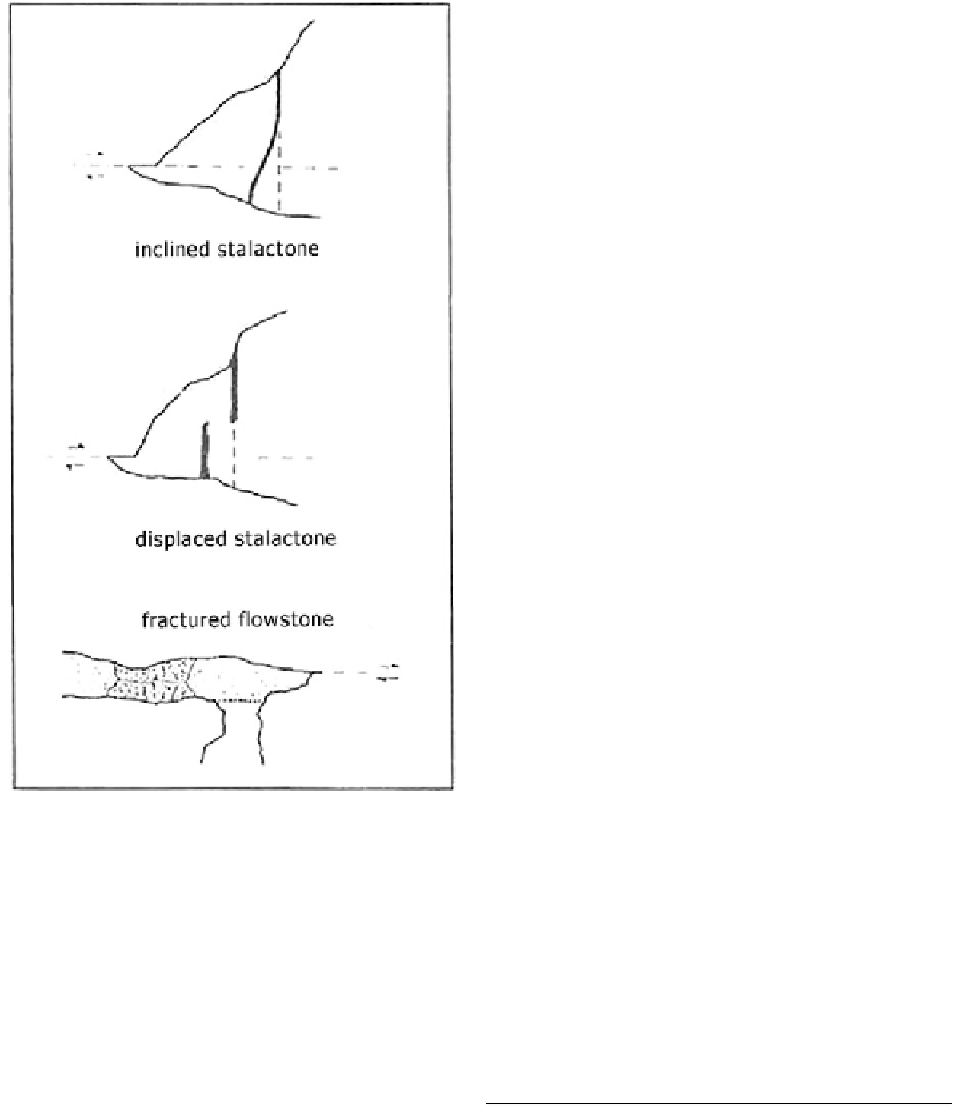
Fig. 3.9
Types of deformations of speleothems caused by
active tectonics in the Siebenhengste-Hohgant cave system,
Switzerland (modified after Jeannin
1990
)
are
installed
in
the
underground
laboratory
in
Rochefort
Cave
near
Namur
in
Ardennes
(a.k.a.
on
0.1
to
few
grams
calcite
samples,
Rochefort Laboratory of Geodynamics).
The show cave Grotta di Gigante near Trieste is
well known because of the geodetic facilities installed
by Prof. Antonio Marussi in 1966. He installed long-
base pendulum tiltmeters sensitive to rotations and
shear deformations of the cave. The original Marussi
recording system, still in function, was photographic,
very stable to humidity, and other external influences.
In December 2003, a new recording system was
installed based on a solid-state acquisition system
intercepting a laser light reflected from a mirror
mounted on the horizontal pendulum beam. The
strong Sumatra-Andaman earthquake of December
depending on the U content of the sample.
The deformed stalagmites and flowstones are cored
and sampled for U-series dating with a drilling machine.
The technique is discussed in detail in the case studies.
3.3
Case Studies
3.3.1
Studies in Stara Planina (Balkan)
Mountains
The karst in Stara Planina Mountains is developed on
about 20 % of the territory of this 550 km long and