Geoscience Reference
In-Depth Information
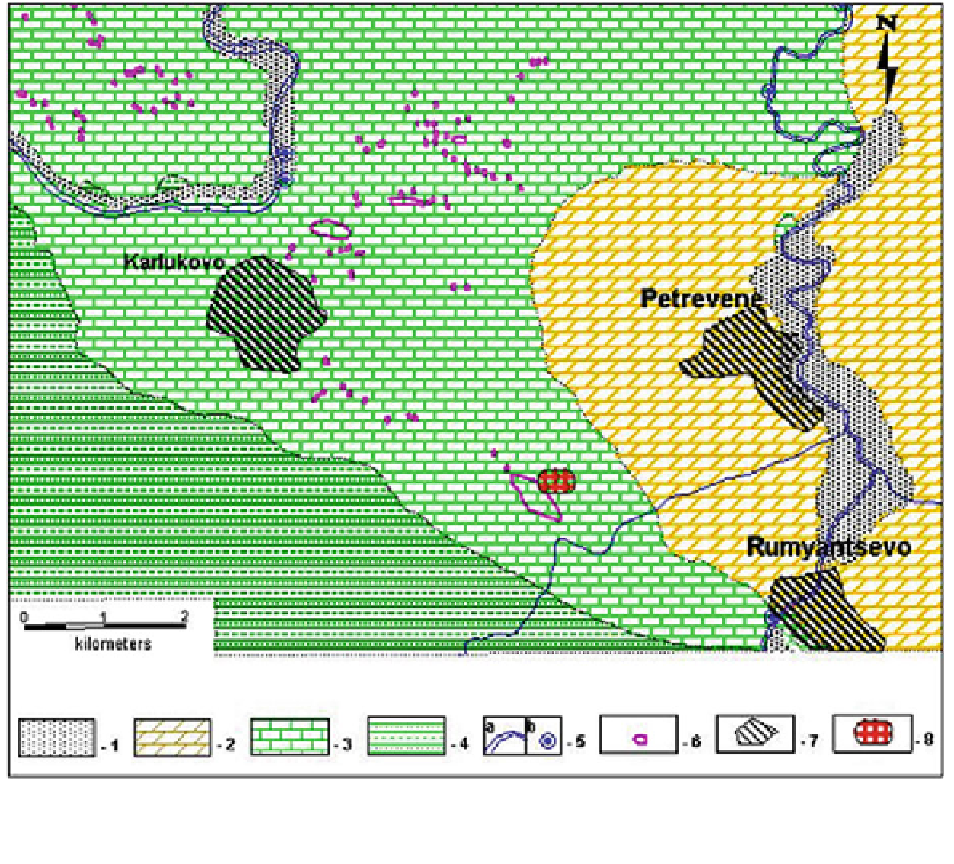
Fig. 2.14
Geological map of the studied area near the village
of Rumyantsevo (according to Tsankov
1991
): 1. Alluvial
deposits—sands, gravels, clays; 2. Paleogene marls, sandstones,
siltstones, clays; 3. Upper Maestrichtian limestone; 4. Lower
Cretaceous sandstones, marls, siltstones; 5. a rivers; b karstic
springs; 6. dolines; 7. villages; 8. studied area
program IPI2WIN gave the position of the cave
between 22.5 and 29.9 m from the surface. The only
point on the electrical curve showing the presence of
the cave is at AB/2 = 25 m. This length of the elec-
trical current supplying array was used for the Method
of Dipole Profiling.
Two types of limestones (according to their elec-
tric properties) are present in the geological cross-
section of the area. Limestones of comparatively high
electric resistivity (1,000 Xm) are defined near the
surface, particularly in the northeastern part of the
area. They could be identified with the third horizon
of Kailaka Formation. Limestones of lower resistivity
(400-600 Xm) are disposed below them with a top at
about 11-15 m depth from the surface. They could be
identified with the second horizon of Kailaka For-
mation. Karst forms are found only in the horizon of
lower resistivity. No available data exist for presence
of such forms in the overlying limestones of higher
resistivity. Electric resistivity of karst cavities is high
(practically
tends
to
infinity).
According
to
VES
curves, q
a
is in the range of 4,000-5,000 Xm.
Measurements at 4 azimuths (N 0, 45, 90, and
135) were carried out near the wellhead. The result
from the array AB/2 = 25 m is very important. It
gave information from the depth of the karst cavity
crossed by the well (Fig.
2.16
). Abrupt changes of
electric parameters (coefficient of anisotropy, eccen-
tricity, direction of the long axis of the anisotropy
ellipse and electrical resistivity) of the rocks were