Geoscience Reference
In-Depth Information
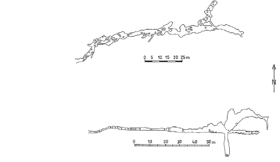
Fig. 3.54
Map and
longitudinal profile of
Shepran Cave (based on data
from Bulgarian Federation of
Speleology)
• Yamata3:
229,000 years
(lower
limit—248,000,
established the existence of three distinct maxima
(Fig.
3.56
), suggesting the impact of three different
phases of tectonic activity.
The orientation in space of the fallen stalagmites in
the cave Shepran Cave almost completely coincides
with that of the deformation in the Yamata Cave. In
both caves are found three well-defined peaks in the
preferred direction of the deformed speleothems. The
caves are situated in parallel blocks marked by sub-
parallel faults of the Zabardo fault zone and are
formed in the downthrown blocks of the faults.
These patterns may indicate the conclusion that the
deformations in caves located in the downthrown
block of a fault are much more significant. This pat-
tern is confirmed by studies in other karst regions in
Bulgaria.
The well morphologically expressed sub-parallel
Dobrostan fault is marked by 300 m high vertical
rock slopes north of Yamata Cave and Shepran Cave.
The large number of deformations in these caves can
be explained by activation of this fault structure in the
Pleistocene with the collapse of the downthrown
block where both the caves are situated. On the other
hand, in the Ahmetyova Dupka Cave (rich of spele-
othems), located close to the fault but in its upthrown
block, significant amount of deformations are not
observed.
upper limit—212 000 years);
• Yamata4:
317,000 years
(lower
limit—348,000,
upper limit—291 000 years).
3.3.2.3 Shepran Cave
The Shepran Cave is located on the southern slopes of
the Dobrostan massif, Western Rhodopes, in the
valley of Belitsa River, about 1 km northwest of
the town of Laki. The cave entrance is at 840 m a.s.l.
The cave was surveyed and studied by Chepelare
Caving Club ''Studenets'' in 1963.
Like the other West Rhodopean caves, this cave is
formed of Proterozoic marble in Dobrostan Formation
(Fig.
3.49
).
The Shepran Cave is a dry, fossil cave with
interesting morphology, consisting of a gallery of
length 260 m and 18 m deep pit at the end (Fig.
3.54
).
The total denivelation of the cave is 39 m and the
volume—3,010 m
3
.
During field studies on the cave in the spring of
2001 a large amount of deformed speleothems were
found. Prevailing fallen stalagmites and many of the
observed forms are covered with thick calcite deposits
and younger formations (Fig.
3.55
).
The
directions
of
46
deformed
formations
are
measured.
From
the
constructed
rose-diagram
is